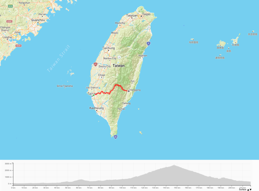
Location: Tainan & Kaohsiung
Distance: 140km Elevation Gain: 3,000m

There are four Cross-Island Highways in Taiwan, three of which traverse the island from west to east, the fourth, ‘the New Central Cross-Island Highway, is a north-to-south traverse that skirts the Central Mountain Range.
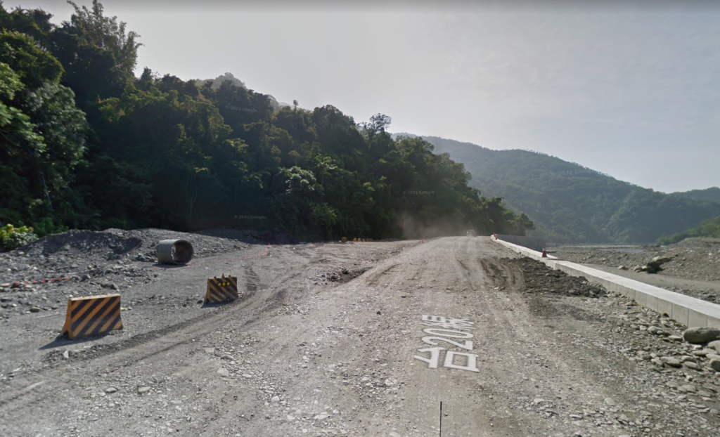
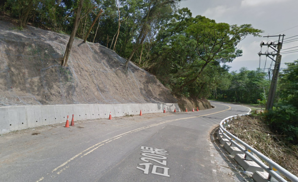
Of the four it could well be argued that the South Cross-Island Highway (Provincial Highway No. 20) is the best for its variety of scenery. Unfortunately, due to a catastrophic typhoon in 2009, a section of this road is closed to cyclists for the time being. The road only reopened to traffic in 2022 after thirteen years of reconstruction. It is hopeful that the 44km section at the top of the road will open to cyclists in the near future.
For our list of the ‘Top 100’ cycling roads in Taiwan, the South Cross west approach is listed as 005 to reflect the fact that it is 2,722m at the summit. (003 covers the more-appealing east approach which has much less traffic), however, at present, the road is only open to Meishan at the 105km marker.
From end to end the road is 203km long starting at the 0km marker in Tainan City and ending at Haiduan in Taitung. The nearest train station is Tainan City station which is just a few kilometers from the start.
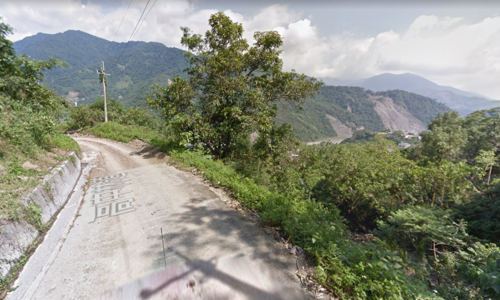
Starting at 0km marker in Tainan this is the least appealing section of the road, but after 10km the rider will exit the suburban area of the city. About 30km into the ride there is an intersection with the No. 20B road, the rider should take the left fork to Yujing (No. 20 36km marker). Although the real climbing hasn’t started yet this section of the road is not flat, there are numerous small hills to get over adding a lot of elevation gain to the ride.
A further 20km into the ride there is another intersection with Provincial Highway No. 29, a left turn here and 3km up the road is the village of Jiaxian, which has numerous restaurants and a 7- 11. It’s important to stock up here as the first real climb of the road starts. This is a stiff 10km ascent of approx. 400m before it descends dramatically down to the village of Laonong (74km marker).
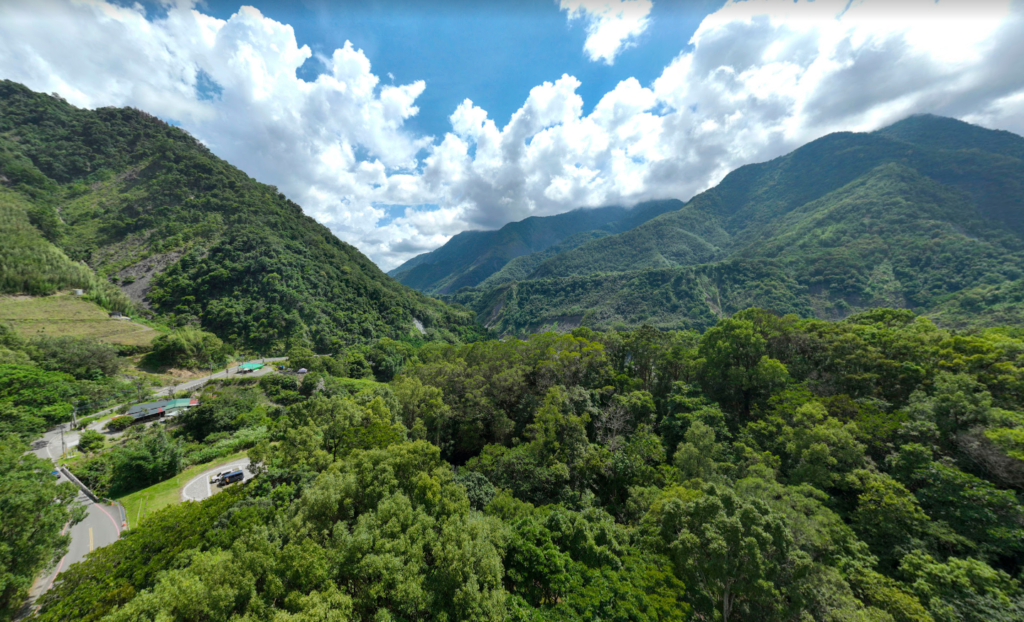
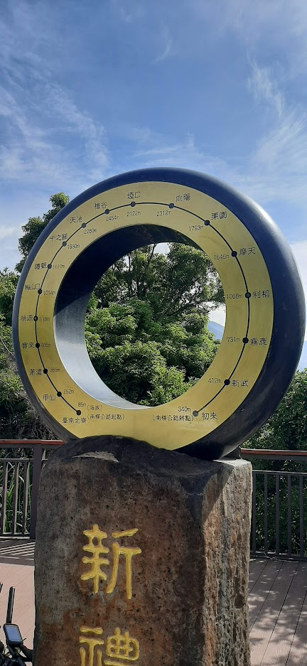
One of the best things about the South Cross is that there is no shortage of supply shops along the way. Just 6km from Laonong is the famous hot spring town of Baolai, a booming area before typhoon Morokot in 2009 and now recovering to something resembling its former glory. This would be the best place to overnight if staging the ride as a 2-day affair. Apart from the springs the No. 20 is a major access route to several of Taiwan’s top 100 Peaks for hikers.
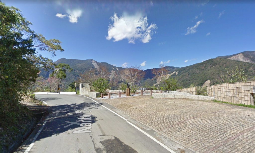
Once the rider leaves Baolai the best of the South Cross starts to show itself. Be aware that every bridge you cross from this point was constructed since 2009, there are too many to count. After 14km heading east the last major town on the road, Taoyuan, is located at the 93km marker. The road at this point is more undulating than climbing, but it steadily rises up 1,015m to the village of Meishan (105km marker). This is as far as the rider can go before encountering the west side checkpoint. There are several shops here for supplies and a few guesthouses that have reopened recently.
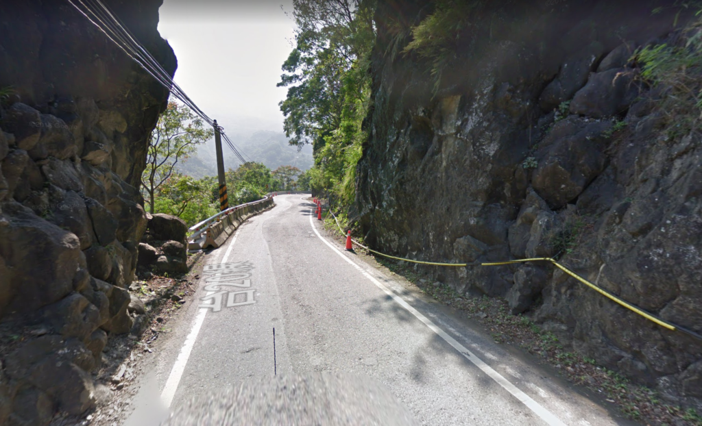
The road to the top, which we are hopeful will open to cyclists in the near future, is nothing short of spectacular. It’s 37km from Meishan to the Yakou tunnel at an altitude of 2,722m. This can, at present, only be done with a support car which must transport the rider to the east side checkpoint at Xiangyang. Because so much of the road was damaged in the typhoon the road km markers have been reassigned. From Meishan to Xiangyang the distance is 44km, there is nothing by way of supply shops along the way and at times the road is too narrow for two cars to pass.
Here are the GPX and KML files.