Location: Nantou
Distance: 58km Elevation Gain: 1,800m

The Nantou No. 89, also known as the Li Sying Industrial Road, is arguably one of the toughest rides for a road bike in Taiwan. It has gained prominence in recent years because of its inclusion in the ‘Dirty Formosan Challenge’. This is a 100km race event on more rural roads and a certain amount of gravel.

The approach to the Nantou 89 is explained in our ‘002’ listing for the west approach to Wuling from Puli. From Puli it is 20km to the town of Wushe in Renai Township on Provincial Highway No. 14. The town is located at 1,000m above sea level and this is the best place to get supplies before entering the No. 89. At this point the No. 14 continues straight to the hot spring town of Lushan. The rider must veer left on the No. 14A
At the 5km marker on No. 14A, there is a left turn onto a side road. This is the start (or end) of the No. 89 proper. This is the 53km marker, all kilometer numbers given below are in descending order to the highest point at 2,483m.
(See the information at the top of this page for an explanation of the road numbering system in Taiwan)
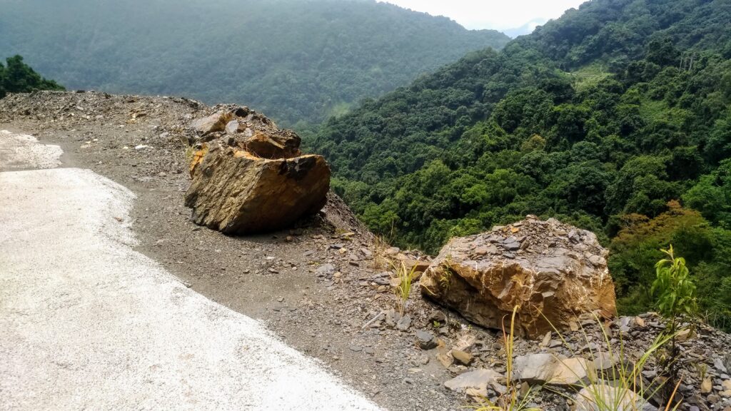
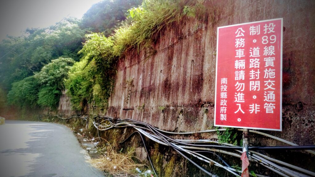
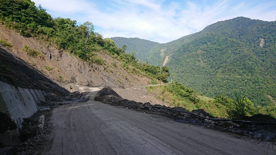
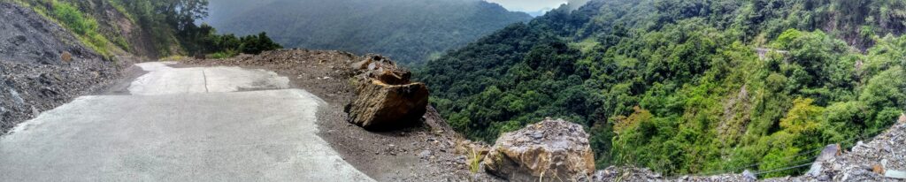
The lower sections are quite well-surfaced, but it degrades a lot the higher the rider goes. It’s exactly 53km to the top. This road is not well maintained and is subject to landslides every year. As an industrial road, very few cars use it and its primary purpose is agriculture. It is also the access point for one of Taiwan’s Top 100 mountain peaks – Baiguda Mt. 3,341m.
At the 40km marker, the road descends for 10km, then it’s all up to the top. After another 5km, there is a small Aborigine village just off the road and this is the only place to get refreshments, but not much food for sale here other than a small noodles shop.

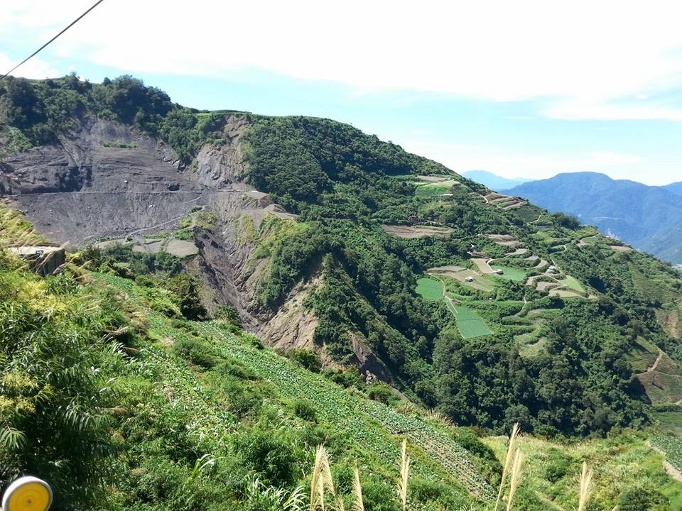
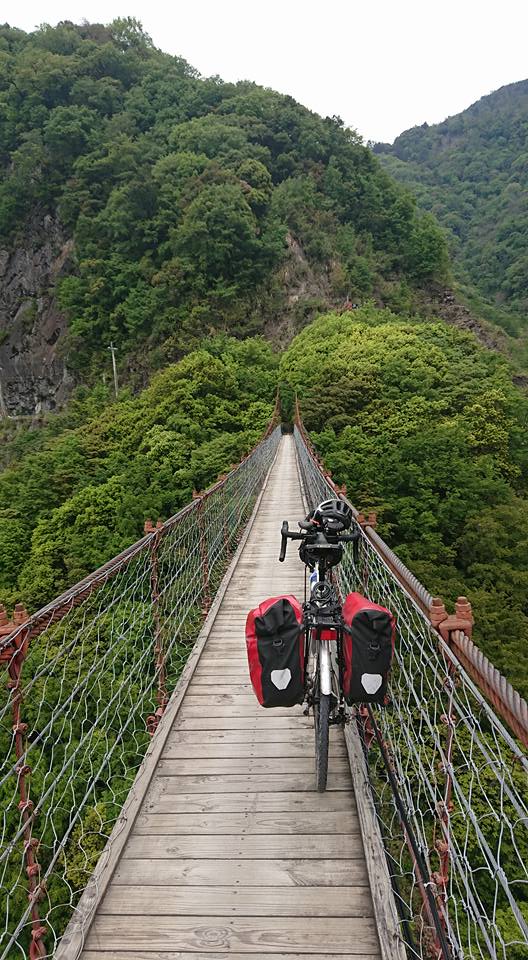
It is worthwhile to ride across the suspension bridge at around the 33km marker. One of the most striking things about this road is the magnificent views over an endless valley dotted with farms all along the way. Not to mention that Snow Mt. 3,886m, Taiwan’s second-largest high mountain peak is also clearly in view as the rider ascends to the top.
The rider should be advised that near the end there are a couple of sections of rough concrete with gradients over 20% – on a touring bike this was walked.
This section at the top is very interesting. There are signs leading the rider to a small pond and a villa that was once the former residence of President Chiang Kai Shek. On the way down there is a farm resort called Fushoushan – a pricy resort that has to be booked well in advance.
From the top, it is 9.5km to the town of Lishan which is a very popular tourist area with lots of options for accommodation and food.
The rider would be well advised not to take on this road unless there is an optimal forecast.
Here are the GPX and KML files.