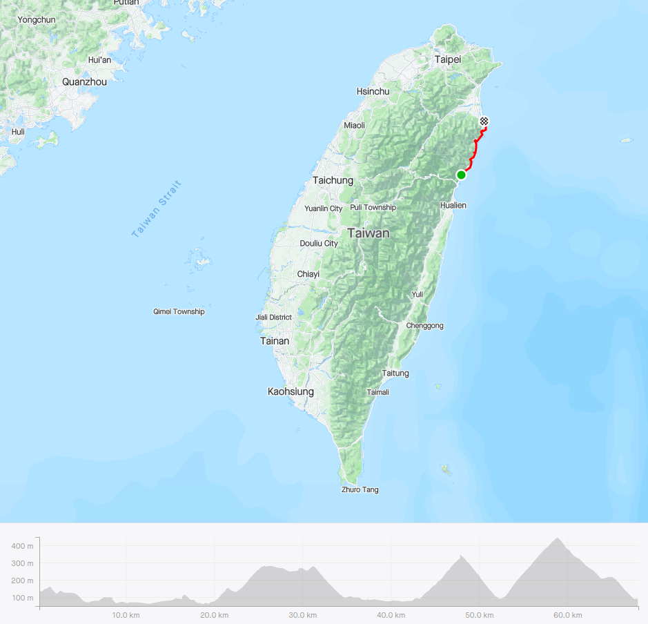
Location: Hualien/Yilan
Distance: 108km Elevation Gain: 1,200m
The Su-Hua Highway is arguably the best section of coast road in Taiwan. Although not a continuous climb there is enough ascent in it to justify its inclusion in our series of the Top 100 Climbs of Taiwan. It is named Su-Hua on account of the north section, where it starts, being located at Suao in Yilan County and terminates in Hualien City.
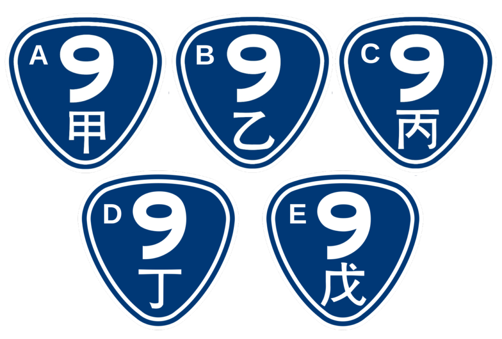
This is a road that really doesn’t get enough attention or shamefully is avoided on account of a previous reputation as being too dangerous to ride. The No.9, at 453.851 km long, is the second-longest provincial highway in Taiwan and passes the regions of Taipei City, New Taipei City, Yilan County, Hualien County, Taitung County, and Pingtung County. There are 5 branch lines of the No. 9. They are listed from A to E and represented with the following Chinese characters on the road. Provincial Highway 9D starts at Su’ao and ends at Xiulin, Hualien. The total length is 69.074 km (42.921 mi). Details on the full length of the No. 9 here: Provincial Highway 9 (Taiwan)
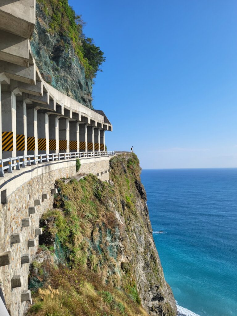
All tour groups, especially Giant Tours, refuse to let riders on this road urging or in some cases forcing them to take the train. In the past, there was some justification for this. Previously this was the only road connecting Hualien to Suao, hugging the coastline along precipitous cliffs there was very little space or wiggle room for a cyclist when two vehicles pass in opposite directions. This was even more terrifying if the rider encountered gravel trucks or tour buses.
In recent years this problem has been alleviated by the construction of four tunnels which divert traffic away from the coast road for most of its length. There are still some sections where the two roads combine, but as long as the rider is aware of this and takes proper precautions to increase visibility I would highly recommend riding it.
Regardless of the time of year, this road should be ridden south to north. This may seem counterintuitive in winter with prevailing wind from the north, but to best appreciate it the rider should be on the right side of the road to maximize the viewing opportunities of the coast.
The best access point is Hualien train station. Just a short distance away it is easy enough to get onto Provincial Highway No. 9 which is the road’s proper number. From here it’s 20km of flat riding out of the city in the direction of Taroko Gorge – one of Taiwan’s premier tourist attractions. (Far more desirable is a detour onto county road No. 193 which runs parallel to the coast and has far less traffic). The number 193 passes Qixing Beach which is the starting point for the Taiwan KOM (see Top 100 001 for more info). There is also the option of cutting out the first 20km by getting off the train at Xincheng station at Taroko Gorge.
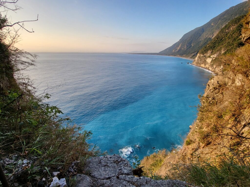
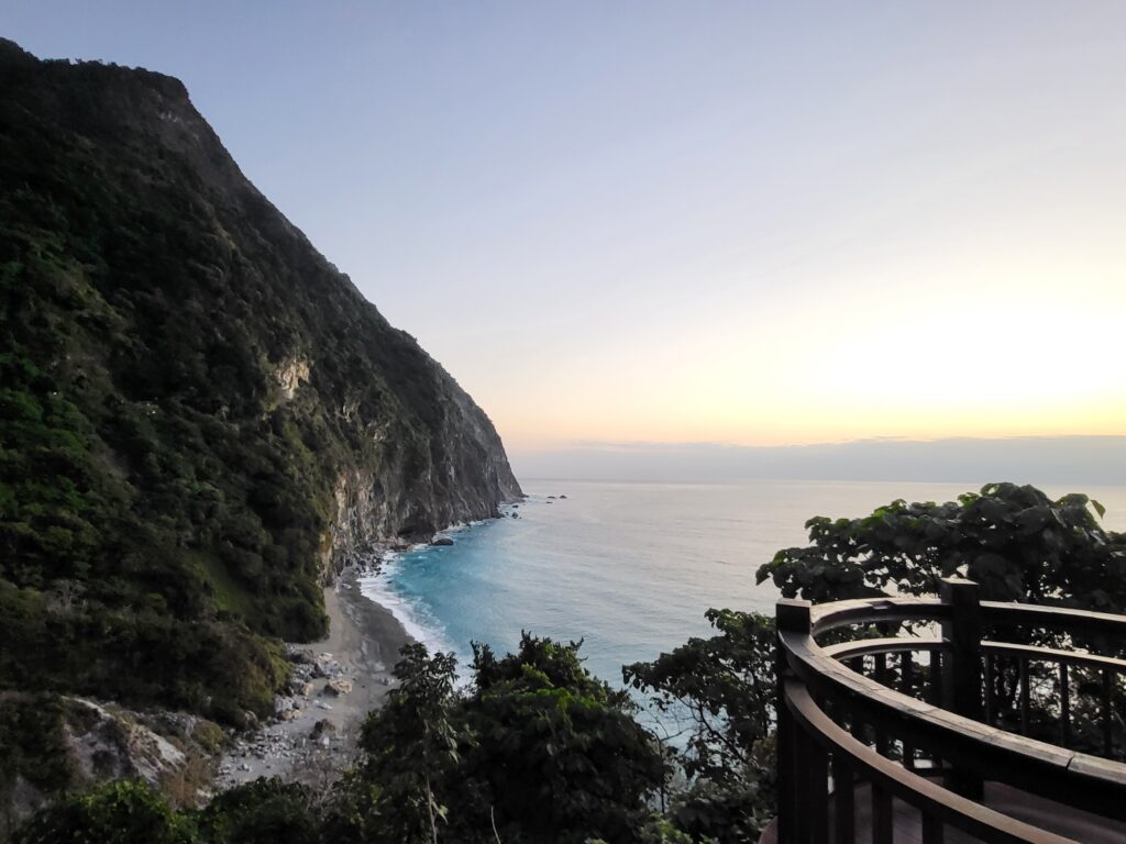
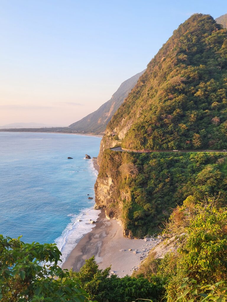
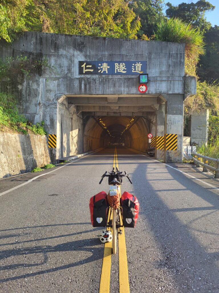
Now 20km into the ride, the rollercoaster of ups and downs begins. It’s shortly after passing the bridge at Taroko Gorge that the first of seven tunnels is encountered. They are old and narrow and caution is advised. Apart from high-viz clothing and lights to increase visibility I would also advise a complete stop to let trucks or buses pass. Ten kilometers after Taroko the rider comes to the first scenic lookout. This is Huide Recreation Area. There is a roadway off to the right for a few hundred meters and this offers commanding views of the Qingshui Cliffs which the area is famous for. There is also a public toilet here.
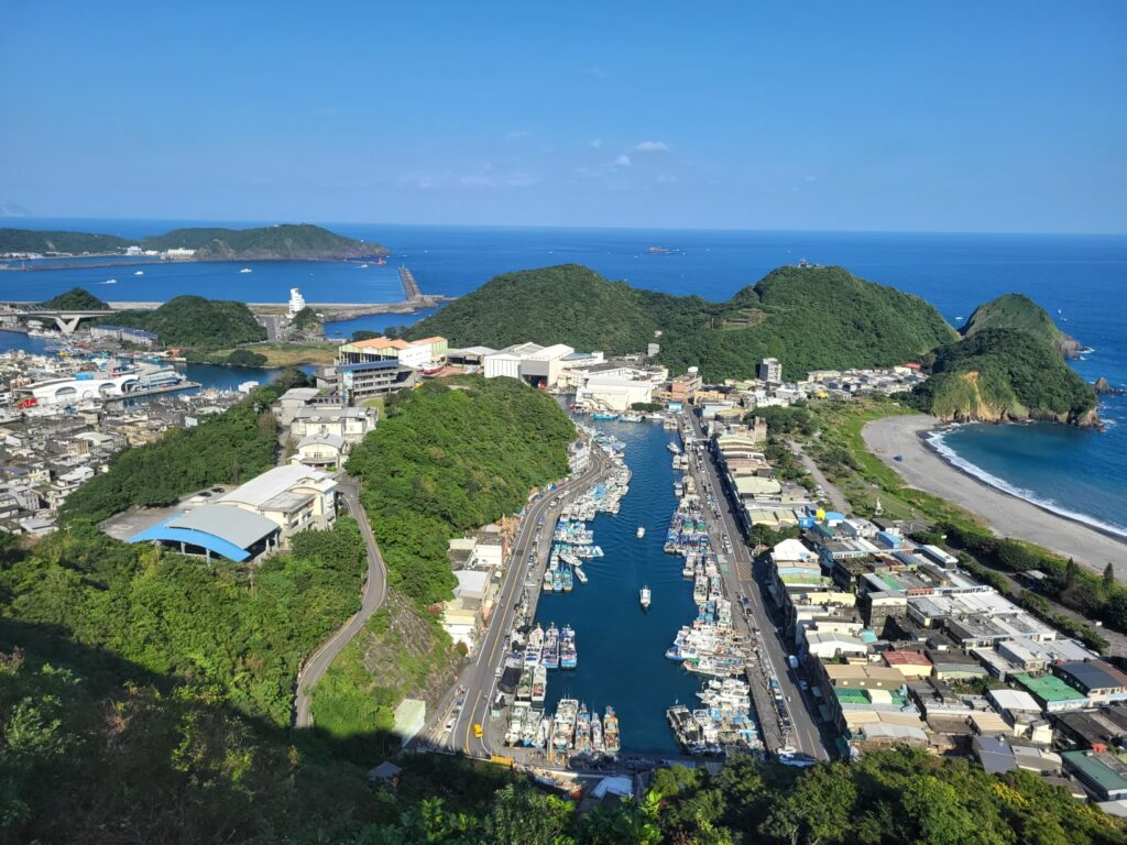
The first town the rider comes to is Heping which has an industrial cement factory about 45km from the start. Apart from picking up supplies, this can be passed through quite quickly. ‘Ao’ means harbor or port in Chinese and there are four along this road – Nanao, Dongao, Nanfanao, and Suao. It’s important to pay attention to these because before each one is where the climbs start before dropping back down to sea level. Nearly all of the port towns are large enough to have a 7 -11 or some sort of shop.
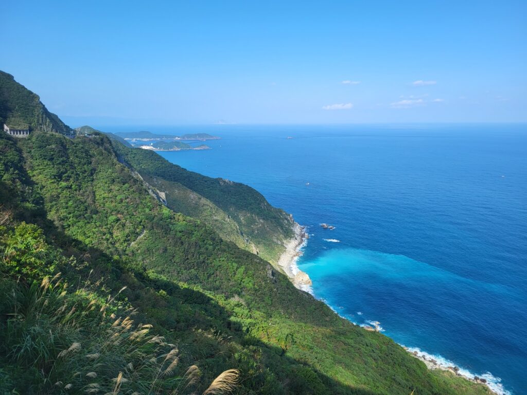
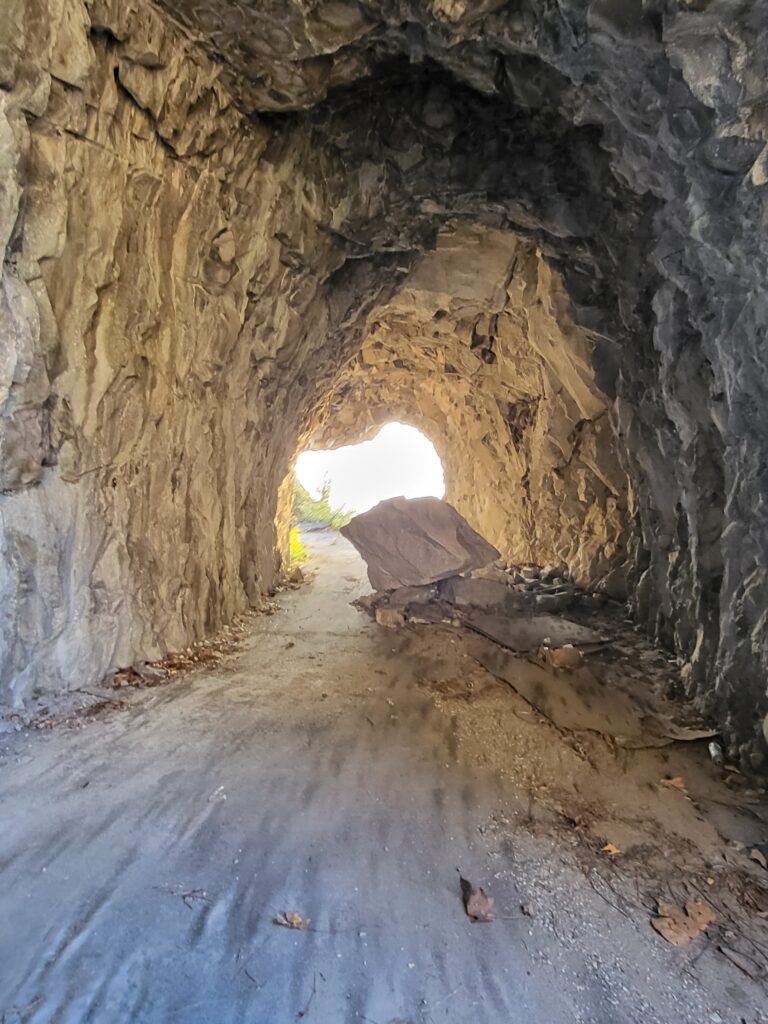
One thing of interest that every rider should stop for is the old sections of road tunnel several of which are passed along the way. Get off the bike and take a stroll through, they are partially blocked with barriers but still accessible. Some of these offer breathtaking views of the ocean.
None of the climbing sections are particularly difficult, the gradient varies from 5 – 7%. If the rider starts at Hualien train station and ends at Suao station the distance is almost exactly 100km with approximately `1,200m of ascent.
Here is the GPS info: