Location: Pingtung
Distance: 27km Elevation Gain: 1,600m
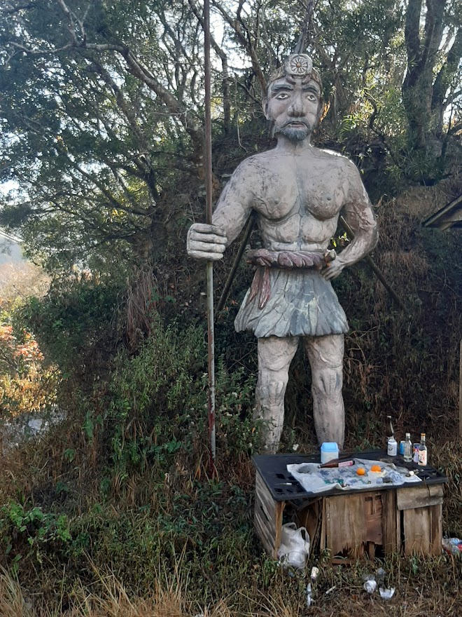
Jinshuiying is unusual to include in this series since the road is far more well-known as a cross-island hiking trail and arguably the best downhill ride in the country. It has a fascinating history dating back to the Qing Dynasty as an Aborigine migration route.

It has been included in this series because the west approach to the trail is accessible by road/gravel bike.

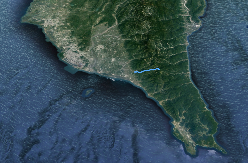
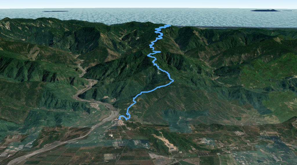
It’s approx’ 60km from central Kaohsiung with the nearest train stations being Donghai or Fangliao on the southwest coast. The approach road is No. 185, known locally as the Yuanshan Public Rd. The 0km marker on this road is at Maolin in northeast Kaohsiung. It runs for 69km ending at Fangliao in Pingtung running parallel to the central mountains.

If the rider starts from Fangliao it’s just 5 – 6km north on the No. 185 to the 64.5km marker. This road is marked on maps as the Ping 198 (Xinkai Rd.) which then becomes the Dasyi Forestry Rd. From this point, it’s 27km to the top ascending to 1,600m.
The rider should stock up with supplies at Fangliao since there are no shops on the road. Another option is to first ride to the village of Guichong. This is an alternative approach with the turn-off at the 62.5km marker on No. 185 Rd. This is a fairly large sized village with convenience stores. From Guichong Elementary School there is a back road that connects to the Dasyi Forestry Rd.
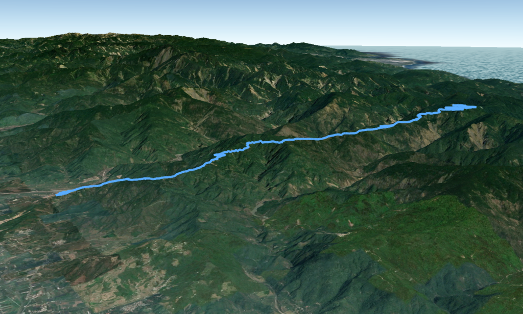
The lower sections of the road are good surface, but after a few kilometers, it’s all very steep concrete to the top. Of most interest to the rider is the fact that as a historical migration route, there are several points of interest along the way.

During the Japanese occupation period from 1895 – 1945, there were numerous structures and small police outposts all along it. Although these are all ruins now there are several signs telling the rider what was formally here such as schools, charcoal kilns, and police stations.
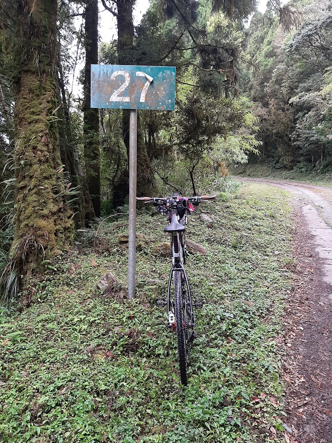
It’s a dramatic ascent with some sections that the rider would be just as fast walking as riding up. Fortunately, it is heavily forested reducing exposure to the sun and there are some great lookout points along the way. The rider would be well-advised to know that the road deteriorates dramatically near the top with lots of ruts in broken concrete that can easily snag a narrow tire. And in wet conditions, there is going to be moss and vegetation, so a wider tire is advisable.
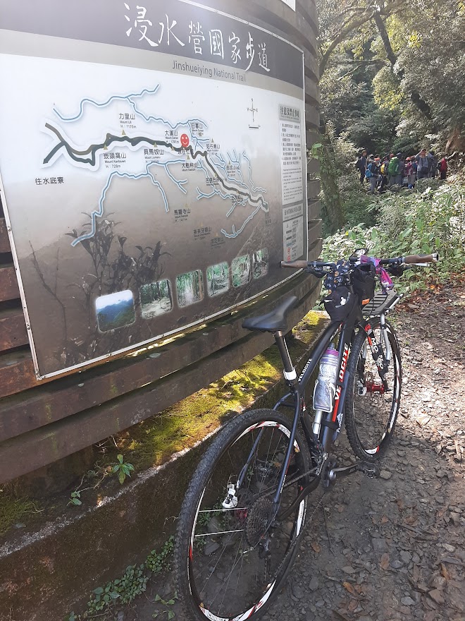
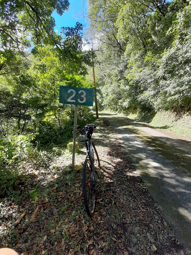
At the 23km marker (1,400m) there is a large clearing where several cars will be parked. This is the start of the hiking/MTB trail down to Dawu in Taitung. There are signs saying bikes aren’t allowed on this, but that doesn’t stop anyone from riding it. If the rider intends to do the full cross-island route a mountain bike with wide tires is essential.
From Fangliao train station to Dawu train station the distance is 54km and with several river crossings on the east side, this is only possible in the dry season.

The rider now only has a further 3km to reach the highest point at 1,600m on the west side. This section of the road is arguably the best part as the views of the central mountains are outstanding. There is a military barracks at the top, so the gate to this is as far as you can go.
The rider should also be aware of the fact that the hike down to the east is very popular and on weekends there will be convoys of vans taking hikers to the top for the trail down. With the road being very narrow in several places it would be advisable to stop and let the cars pass.

It would be possible to ride up from the west and then hike for a couple of hours down to the east side, but this wouldn’t be advisable in one day. Camping at the top would be a better option.

If you are interested in the hike from the east side, you can read that article here.
Here are the GPX and KML files.