Location: Pingtung
Distance: 28km Elevation Gain: 1.300m
For people living in the Kaohsiung/Pingtung area, one of the most iconic rides is to Wutai Village in Pingtung. As an area that gets a lot of tourist traffic, it’s definitely the best-surfaced road in a mountain area. However, the rider must be aware of additional traffic on weekends.

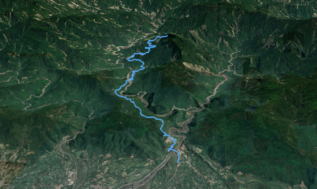
To ride from central Kaohsiung involves a 40-km flat ride to the start of the climb which isn’t very exciting. One option is to take the train to Pingtung station and start from there. This reduces the access route to 20 km.

Provincial Highway No. 24 0km marker starts from the outskirts of central Pingtung. Once you get on this road you stay on it till the very end. At the 20km marker, the rider reaches Sandimen, a busy village with lots of restaurants and convenience stores to stock up. There is also a 7-11 at the 23km marker.
This is the start of a very steep climb, but you get to take a break at the police checkpoint at the 26.5km marker. All visitors must sign in here. There is a water dispenser beside the police station.
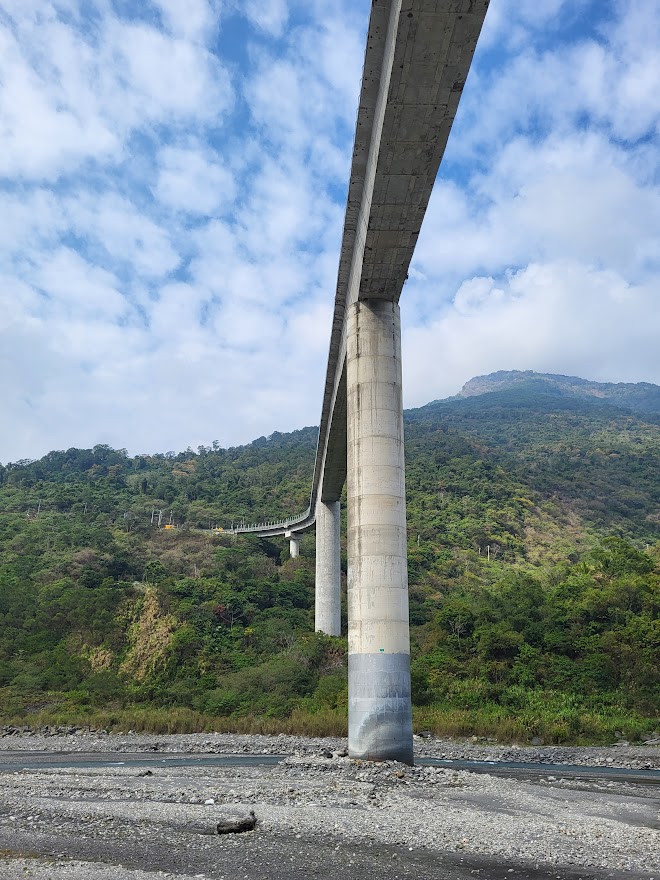
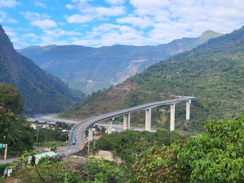
The road continues climbing to the 27.5km marker where the first sighting of the highest bridge in Taiwan is located. At 90m from the river bed, it’s an impressive structure. There are lookout points on both sides of the bridge.
From here there is a fast downhill section for 5 km until the bridge is crossed. Take a right here to Guchuan Village under the bridge if you want an alternative angle photo op.

Back to the climb and amazing views of the surrounding mountains. Shenshan Village (with a 7-11) is at the 37.5km marker, Some riders will take a break here, but most will continue to the end of the climb and stop here for refreshments on the way down. There are several shops selling fig jelly (aiyu) which is great on a hot day. Also good for mountain pork BBQ.

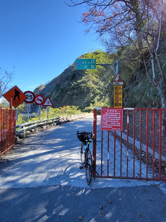
Wutai Village, located at the 39km marker, is a stunning destination that draws in numerous visitors with its impressive stone and slate buildings. As the rider continues uphill, they will encounter the first gate at the 45km marker. Many riders turn back at this point, especially if the gate is locked, as the road beyond the gate is not well-maintained. Therefore, the first gate marks the end of the good surface road.
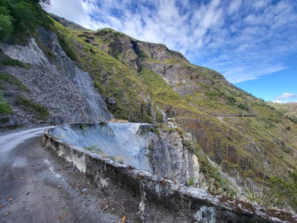
If this gate is open the rider can continue on for another 3kms to the second gate which is always closed. The surface for the last 3 km is gravel and there is a huge landslide area to cross.
Here are the KML and GPS files.
Good stuff, looks great.