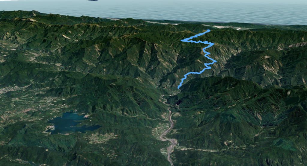
Location: Nantou
Distance: 55km Elevation Gain: 2,700m
A 50km ride to a lake at 3,000m is the highest off-road route in Taiwan.

By far the most remote and difficult to access of the Top 100 climbs by bicycle has to be the Danda Forest Road. A permit is necessary to access this road and this can be applied for from the Forestry Bureau online.
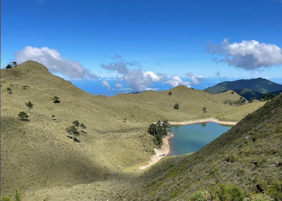
Over a distance of 50km, the rider starts at an elevation of 900m ascending to 2,990m to the edge of Cicai (7-Colors) Lake.

Some of the complications involved are the facts that it is not accessible all year round on account of a river crossing that only has a temporary bridge in the dry season. Also, a permit from the Forestry Bureau is required in advance.

For those willing to persist to overcome these obstacles the rewards of the ride itself make it a dream ride on par with any in the world.
This route was only opened to bikers at the beginning of 2021 having been closed to all traffic for years on account of typhoon damage to the road.
For anyone who wants to camp up top, there is the option of employing Aborigine motorbike porters to transport gear to the top. This isn’t cheap, but it beats having to load everything onto the bikes.

Getting There:
Most riders will use private transport to get their bikes to the beginning of the trail, but it is possible to get there by train. The nearest train station is Shuili, which is one of the stops on the narrow gauge Jiji Line. All cyclists in Taiwan are familiar with this location as it is the starting point of (006?? North approach to Tatajia on the Provincial Highway No. 16) This is also the best option for indoor accommodation the night before the ride.
It’s approximately 30km from Shuili train station on Provincial Highway No. 16 to the checkpoint access of the Danda Forestry Rd. As the rider ascends on this road it gets narrower with barely space for two cars to pass. There is a village called Dili along the way and this is the only point to pick up supplies. No 7 -11, just local shops to pick up water.
If attempting to do Danda as a one-day ride it would be wise to spend the night in this area. There are several campsites, but very few indoor options for accommodation.
At the 0km marker on the Danda Rd. there is a bridge over the convergence of the Zhuoshui and Danda Rivers. During the summer months, this temporary bridge gets washed out.

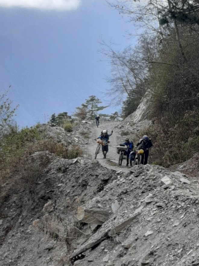
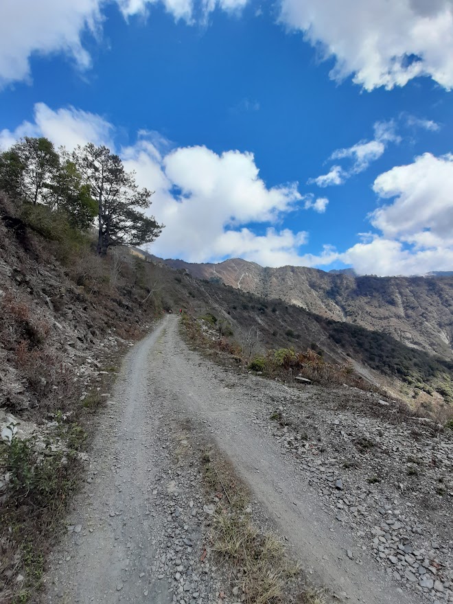
At an elevation of 900m the gravel section of the road begins. There is a lot of loose shale to navigate over landslide areas and a few places where walking is about the same speed as riding unless you’ve got good mountain legs.

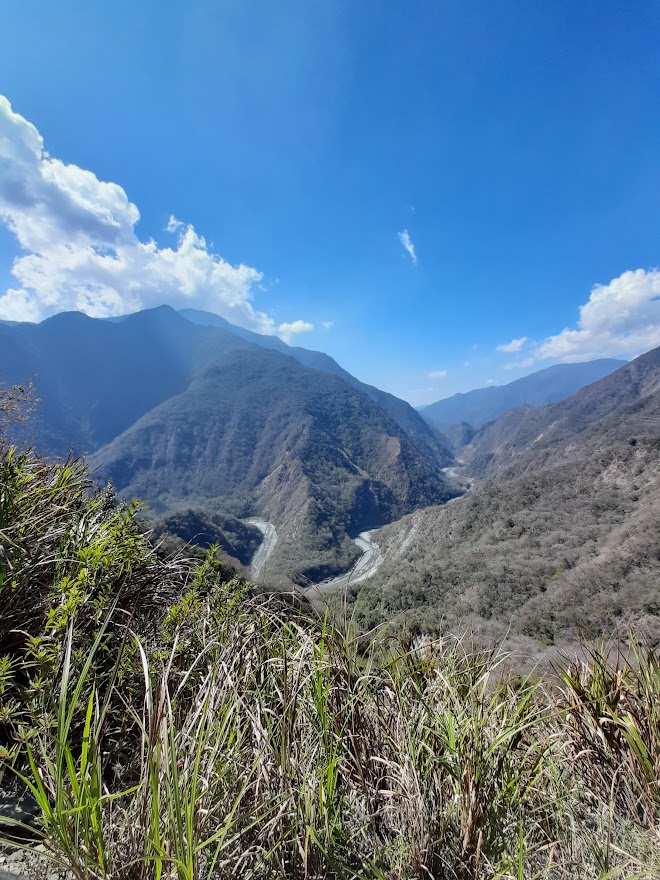
This is all more than compensated for by the spectacular scenery along the way. The Danda River flows parallel to the road on the right-hand side with layer upon layer of mountains way into the distance.
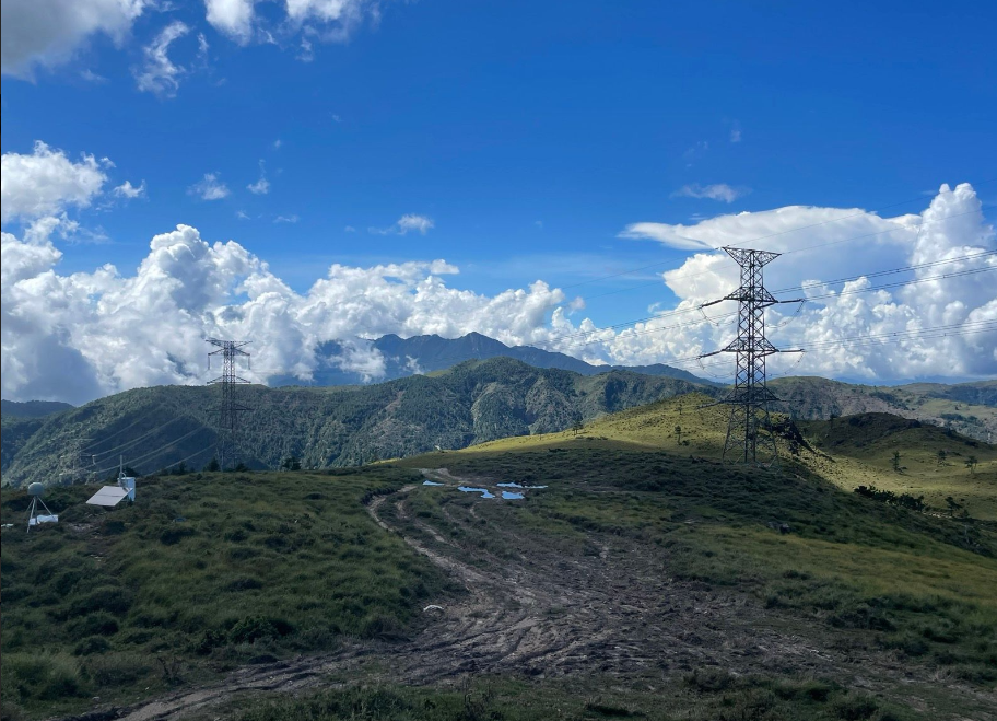
At the 37km mark on the road, there is an old workers hut where the rider can camp for the night if getting to the top in one day is too much. I saw several riders on garden variety bikes with make-shift racks loaded with gear. A lot of these guys didn’t make it to the top with some quitting at the halfway mark to descend. Not surprising really when there are several sections where the gradient is over 20%.

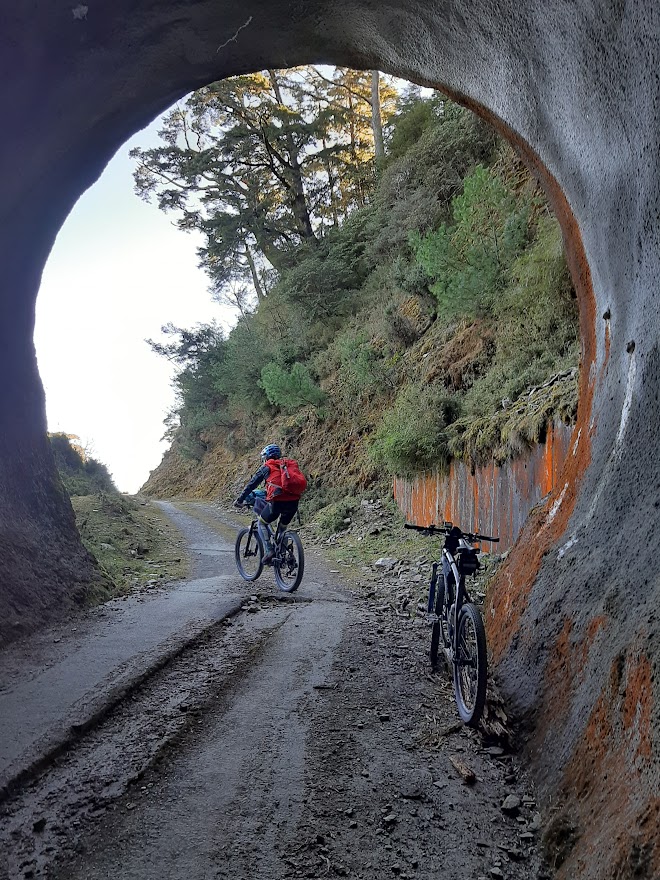
Higher up the slopes there are several wonderful forest sections and a couple of tunnels to pass through. The highlight, of course, is getting to the top and the first view of the lake itself. Great place for a dip on a hot day and there’s a trail around it if you have the time for a stroll.

The reason the lake is called ‘7-Colors’ is because as the sun rises over it in the early morning it appears to change to multiple colors with the changing light.
What goes up must come down and this has to be one of the best rides I’ve done in Taiwan. I would advise the rider to take it easy over the shale sections going down. The wheels of your bike can flip this up and one of our riders got his rear derailleur smashed up.

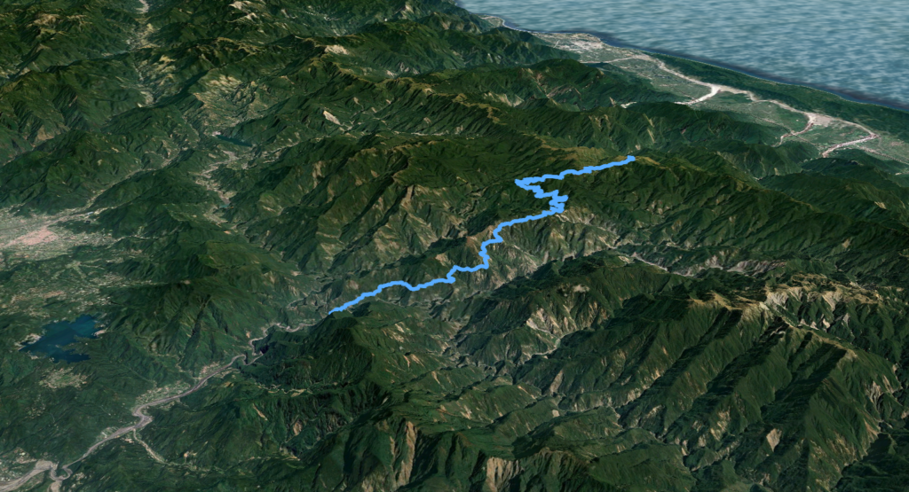
Here are the KML and GPX files.
The following article appeared in the Taipei Times and offers a more detailed account of the trail.