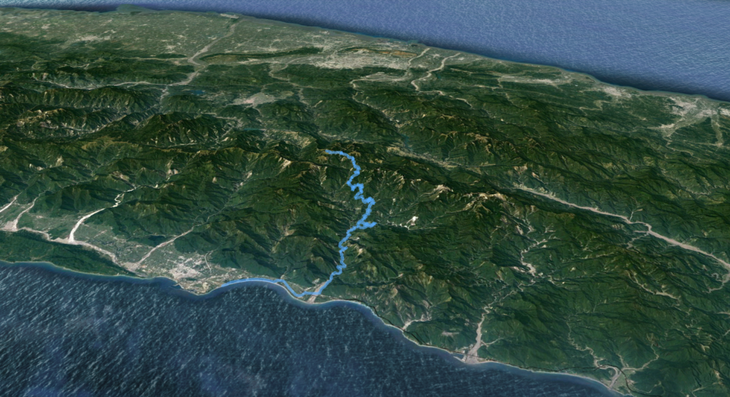
Location: Hualien
Distance: 90km Elevation Gain: 3,500m
Mission Statement:
It is well known among mountaineers in Taiwan that the country has some 270 peaks over 3,000m, making it one of the highest concentrations of 3,000m peaks in the world. Of these, 100 were selected as the primary peaks or the ‘Top 100’. There is also a similar list of ‘Small 100 Peaks’ which are all below 3,000m and created to encourage people to venture outdoors.
With this in mind, it seems only logical, in a country famous for its bicycle industry, that a ‘Top 100’ peaks be created that will list the best ascents that can be achieved on a bicycle.

The most iconic of Taiwan’s climbs on fantastic country roads is the Taiwan KOM, (King of the Mountains). Locally, we call it Wuling, the location of the summit at 3,275m. It is also called the Central Cross-Island Highway or Hohuan Mt. because of the numerous 3,000m+ peaks that are accessible from the road.
First a note on altitude and climate: Altitude is the great equalizer that any, regardless of age or fitness, can succumb to. Some people can ride up to 3,000m with no ill effect, they are the lucky ones. The oxygen concentration in the air decreases by 8% for every thousand meters you ascend. This translates to 24% less oxygen at 3,000m than you have at sea level. The effects of altitude sickness are well documented, lack of breath, nausea, headache, and disorientation. It cannot be stressed enough the benefits of putting in proper training before embarking on an ascent as dramatic as the Taiwan KOM. Ideally, the rider will spend time at altitudes between one and two thousand meters to help acclimate. The solution to altitude sickness is simple – go down immediately, even descending 500m can be enough to recover.

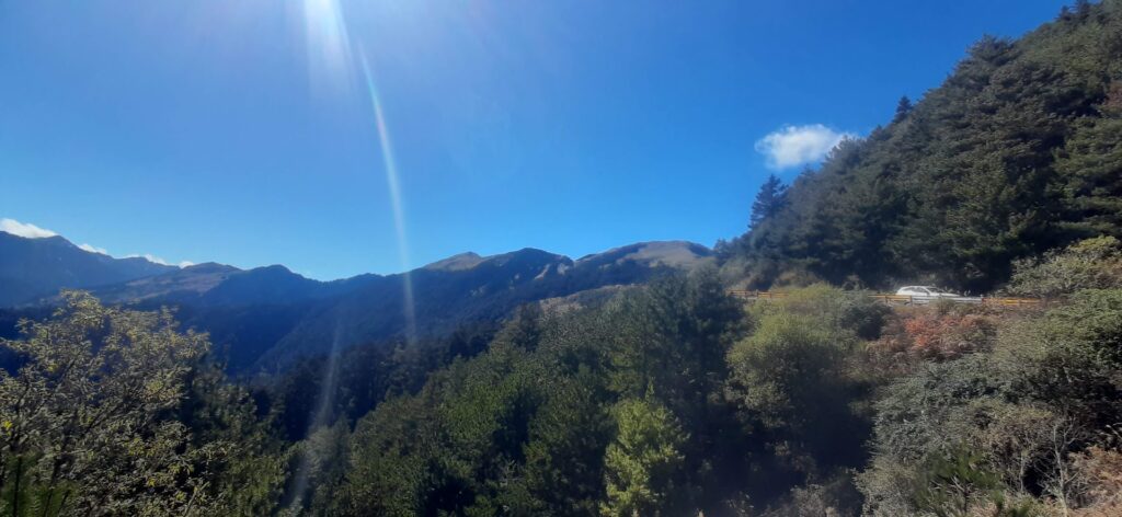
Temperature at altitude: The general rule is that the temperature at altitude is 6 degrees centigrade cooler for every one thousand meters you ascend. This is something that catches riders off guard riding up to Wuling. It could be 30C. in Hualien by the coast, but it will be at least 18C. cooler up at Wuling and this would be in perfect conditions. The mountains are more exposed, the Hehuan area is almost guaranteed to get snow in the winter. So, don’t let the fact that you are living in a sub-tropical climate of the lowlands of Taiwan catch you off guard. From experience, I can tell you that one winter riding up to see snow on top the forecast was -20C for early morning. I was anticipating this and had full winter thermals with me for the ride.
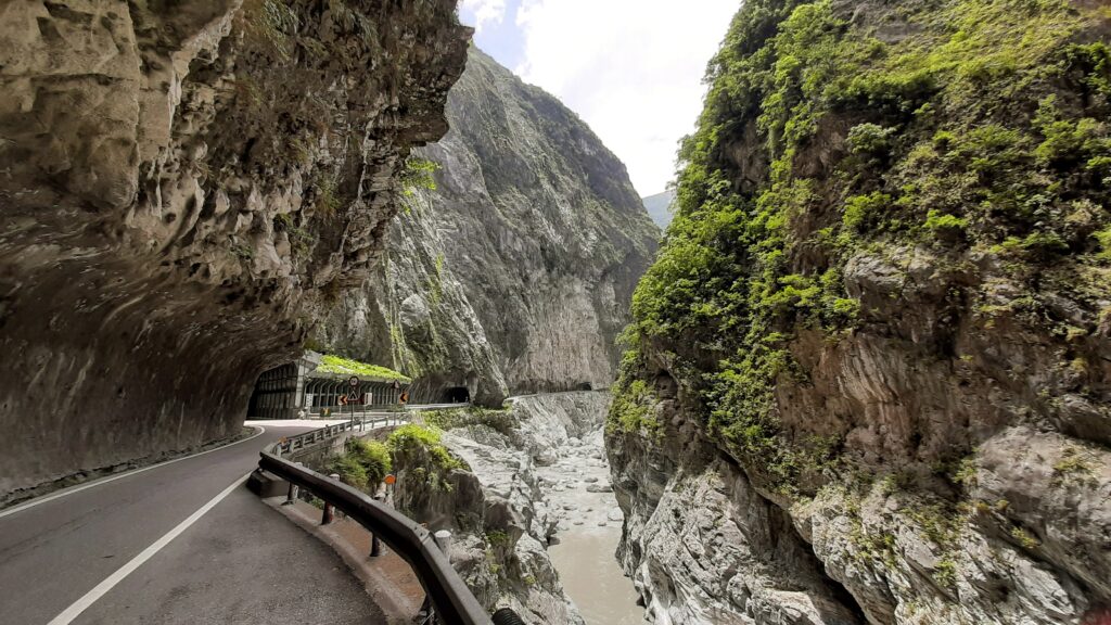
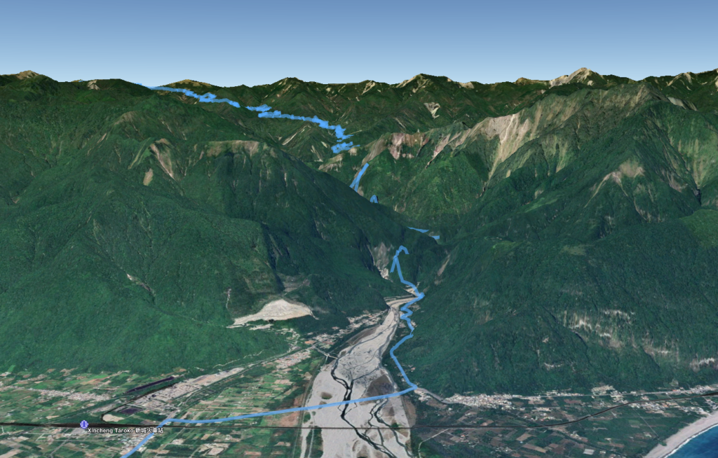
Preparation and equipment: It has attracted international attention because of the formal race event which starts at sea level at Cisingtan Beach in Hualien on the east coast to Taiwan’s highest paved road. The race event covers a distance of 105km – the first 20km or so is neutral until it reaches the entrance to Taroko Gorge.
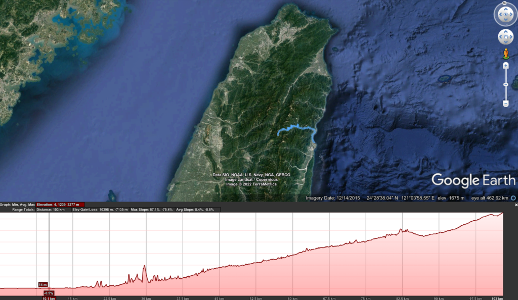
The best way to access Taroko Gorge and the Wuling climb is first to get to Hualien. Ideally, the rider will overnight somewhere in the vicinity of the gorge rather than Hualien City, which is 30km from the gorge. The nearest train station is Xincheng, this is a very popular tourist area and there are plenty of guest houses and hotels to choose from. The road that the KOM is on is Provincial Highway No. 8 – the 189km marker tells you that you are at its eastern endpoint. Eighty km further up the road, it meets Provincial Highway No. 14A, which after 10 km takes the rider to the glory of the highest point.
Now to the ride itself. For a start, I would advise anyone attempting this as a one-day ascent to start at first light. With a start time of 6 am the rider has to judge exactly how long it is going to take to reach the top. At a moderate pace for the average rider that could be 7 – 9 hours allowing for breaks. I would advise a summit time no later than 2 pm in the afternoon and this will allow enough day light time to descend to a safer altitude. This is especially important if returning to Hualien up and back the same way. On the east side of the Central Mountains, there are very few options for an overnight stay. There is much more by way of accommodation on the west side of the mountains.
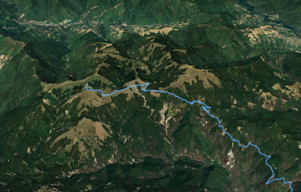
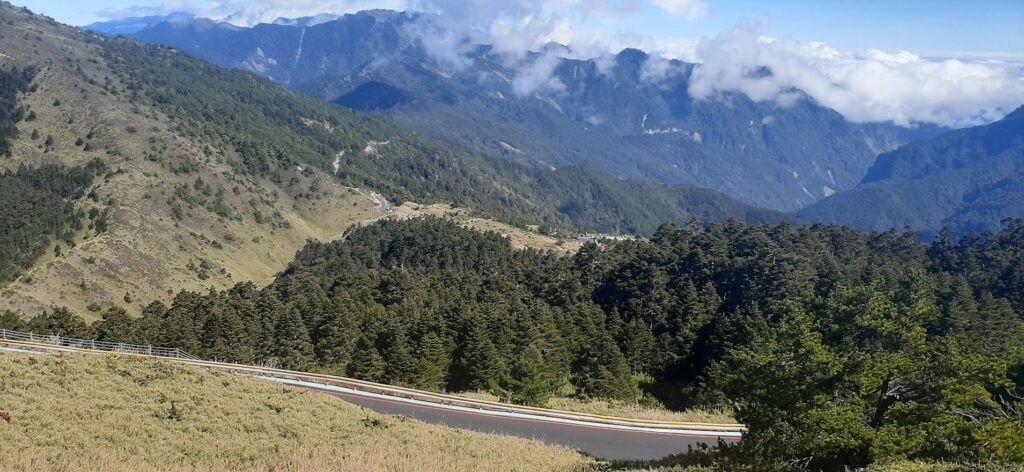
The toughest question the rider has to ask himself is how long will it take to ride approximately 90km of uphill with a total ascent of 3,500m (there are two short downhill sections along the way adding to the total climb). There is only one major feed station on the road and this is at the top of Taroko Gorge proper. Just 20km into the ride you’ll find a 7-11 convenience store on the right-hand side of the road and this is the best opportunity to buy food and drinks that will carry you through the day. Although there are a few mum-and-pop shops higher up they can’t be relied on to be open regularly. There is one coffee shop that serves food at Bilu Big Tree 60km into the ride at 2,150m and the Taroko National Park HQ has a snack shop 85km into the ride, 3,000m.
Although the gradient of this climb is moderate most of the way, 5 – 8% this should not fool the rider into complacency. The toughest part of the climb is the last 10km to the top. At 80km into the ride you reach Dayuling, 2,565m, this means there is still 700m of ascent to the finish and the gradient in some places is over 20%. The road is also completely exposed with few places to shelter.
Here are the GPX and KML files.