Location: Hualien/Taitung
Distance: 150km Elevation Gain: 2,000m
The East Coast and the Rift Valley of Taiwan are often touted as the premier riding locations in the country and that is why we have included 3 rides that form loops to connect the two.
The first of these is located in Taitung and listed as #036 in our series – the ‘Double 23 Loop’ In Taitung. The second one is located in Hualien and combines a loop connecting Provincial Highways No.s 9 and 11. This is a more remote part of the country, but access is convenient by train if the rider hasn’t got a car.
If travelling from south Taiwan Yuli Township train station would be the logical starting point. From the north take the train to the rafting and hot spring town of Ruei Suei. Both of these towns are located on Provincial Highway No. 9.
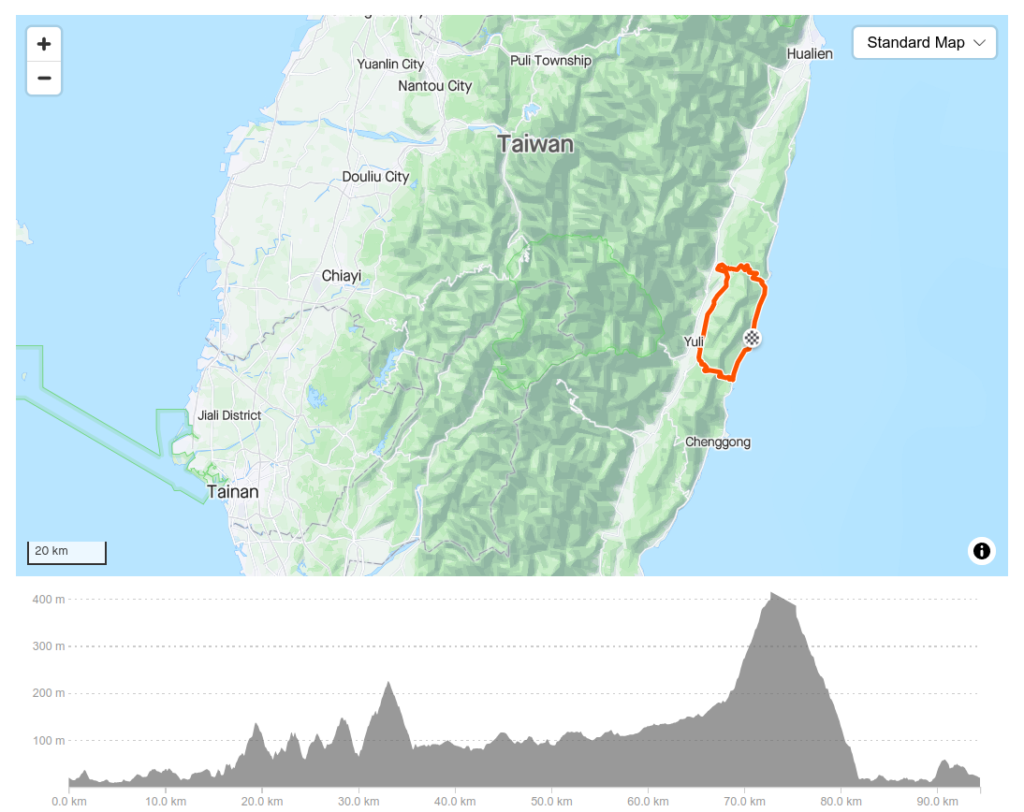
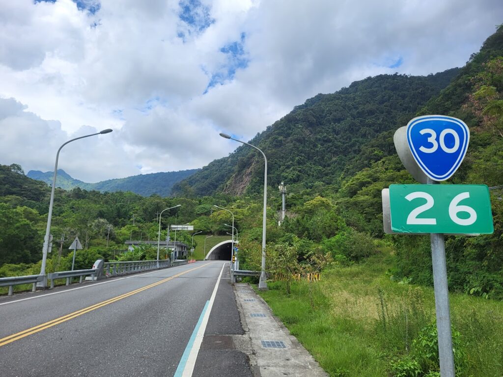
A right turn out of the train station will take the rider to the 10km marker on Provincial Highway No. 30. The first 10km is flat to moderate grade before the climb begins at Antong Hot Springs. This is one of the earliest hot spring areas developed during the Japanese occupation. From here it’s only a 6km ascent to the highest point on the road at 410m. Here you enter a 2.6km long tunnel – lights recommended.
This road tends to be busy on weekends, but it is wide and well-surfaced. The downhill to the coast is approx’ 7kms and pops out at the 95km marker on Provincial Highway No. 11. Turn left heading north up the coast road to approach the second half of the ride on the Hua 64, which is 26kms end to end.
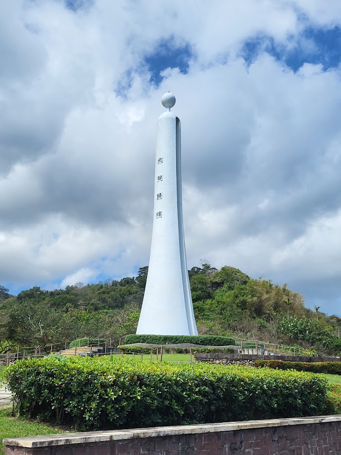
Along the way you will pass Changbin township at the 84km marker, this is the best place to refuel before getting to the Hua 64. The Tropic of Cancer monument, a must-stop for tourists, is about 12km north of Changbin.
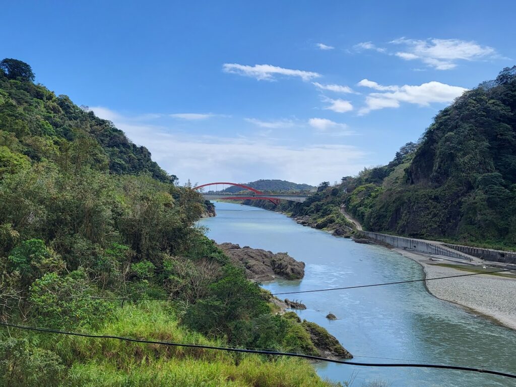
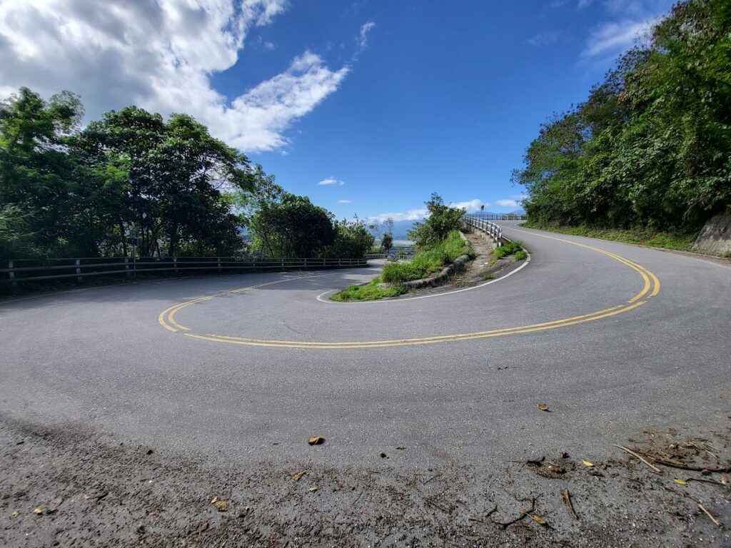
On the No. 11 at 67.5km marker is the turn-off for the Hua 64 which you can’t miss since you have to cross one of Taiwan’s iconic red bridges before getting to it. The 64 is an excellent cycling road for a number of reasons. It’s a great climb right from the beginning. After the initial steep ascent, there are several kilometers of rolling hills, three distinct hills. There are no extremely steep moments but gradients hit 10% in a few sections.
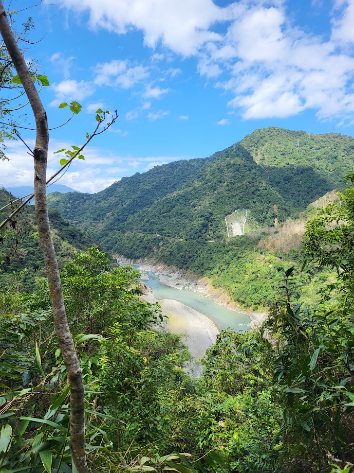
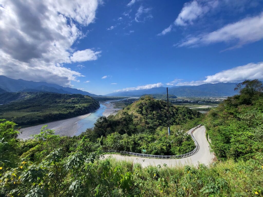
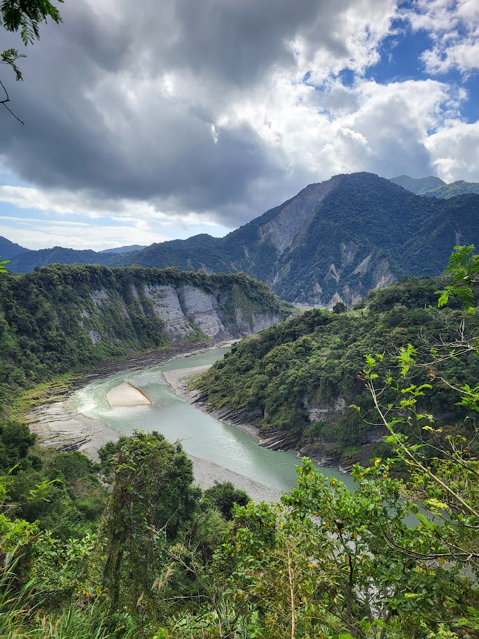
Second, is the views of the Xiuguluan River valley which runs parallel to the road – this is the primary rafting location in Taiwan. Although the surface of the road is good it is quite narrow most of the way with barely enough room for two cars to pass.
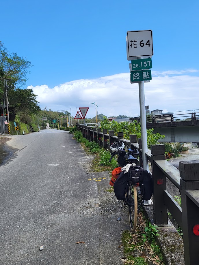
After a great downhill you exit the road at the town of Ruei Suei to get back on the No. 9. From here, turn left to go south for a fast flat roll back to the start point of Yuli.
In total, the ride comes out at roughly 100km with around 1,500m of ascent.