Location: Yunlin/Chiayi County
Distance: 50km Elevation Gain: 1800m+
We have covered several roads in our series that make up the labyrinth of fantastic climbing in Nantou, Yunlin, and Chiayi County. After multiple trips to scout and research this area, we are finally able to publish the last road we need to cover – County Road No. 169. Fortunately, or unfortunately, depending on how you look at it, this is the most difficult to access.
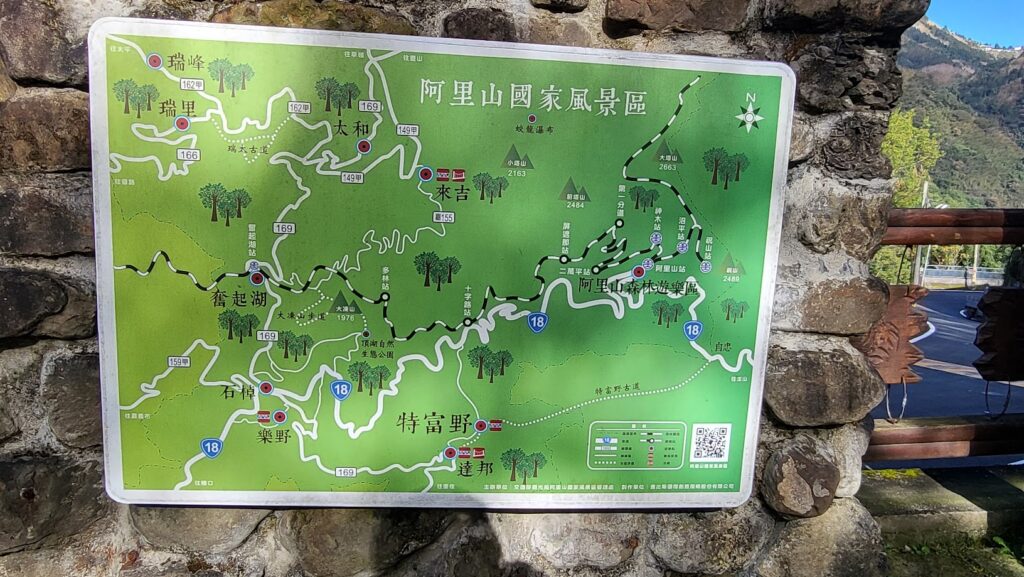
To start, a quick look at the map below will inform the rider that the No. 169 is a north-south traverse that runs parallel to the Jade Mt. range and right through the Alishan area. The 22km of the north section can be completed as a traverse encompassing some of the other great roads in the area. However, the south section has to be done as an out and back.
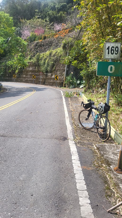
The easiest way to access the start point (0km marker on the No. 169) would be from Douliou train station in Yunlin County. This access has been recorded in #050 – Yunlin County Road No. 149A of our series – access to the No. 169 is a turn off to the right at the 44km marker on the No. 149A.
On this particular occasion, I opted for an alternative approach from Dounan train station, which involved a combination of three different roads as can be seen in the GPX below. This involved a 50km ride with 1,400m ascent through the coffee and tea plantations of Gukeng and Huashan. For this section, there is an abundance of cafes and small villages to pick up supplies.
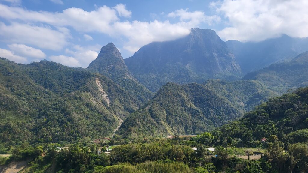
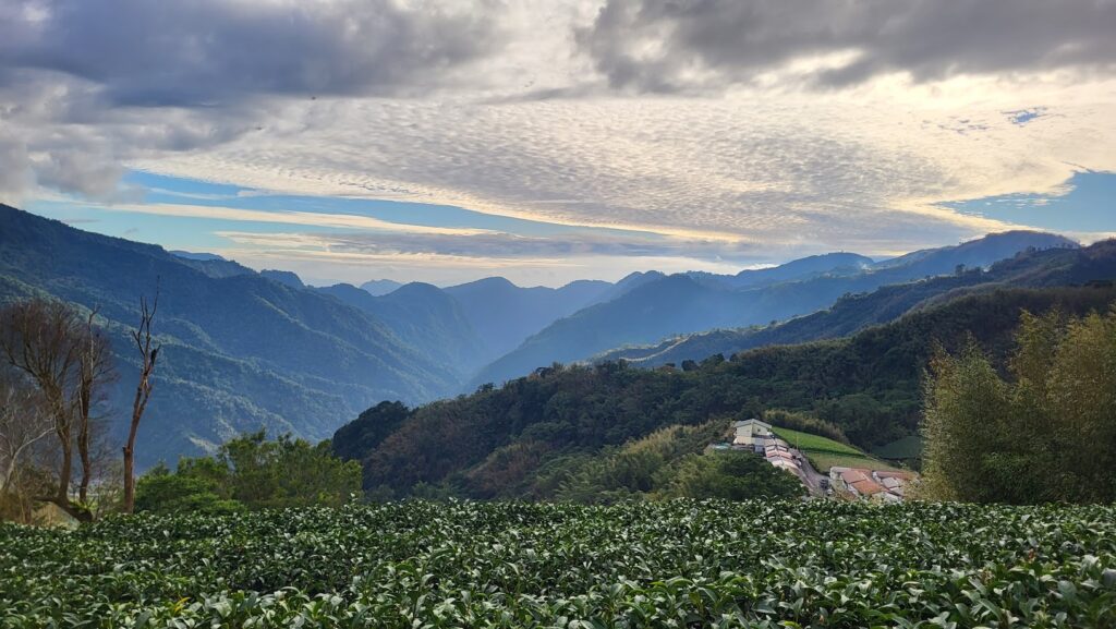
The 0km marker on the 169 involves crossing Shexing Bridge over the Alishan River. The elevation here is just 600m, over the next 14km the road ascends more than 1,000m, making it one of the steepest sections in Taiwan. This is not a well maintained or well-travelled road and as such the surface is rough in places. Despite that, the scenery is spectacular, and the remote nature of the area means the only traffic is farmers in blue trucks.
There are a couple of small villages higher up where drinks can be bought, but not much food and no restaurants as such. Once you reach the top, it’s a 3km gentle roll down to Fenchihu – this is a major tourist area as it is one of the stops on the Alishan Railway. Lots of traffic here, especially in spring for the Cherry Blossom season. Another 5km down the road, the rider comes to Shizhao on Provincial Highway No. 18 (#006 – Alishan/ Provincial Highway No 18). Lots of accommodation and food options here.
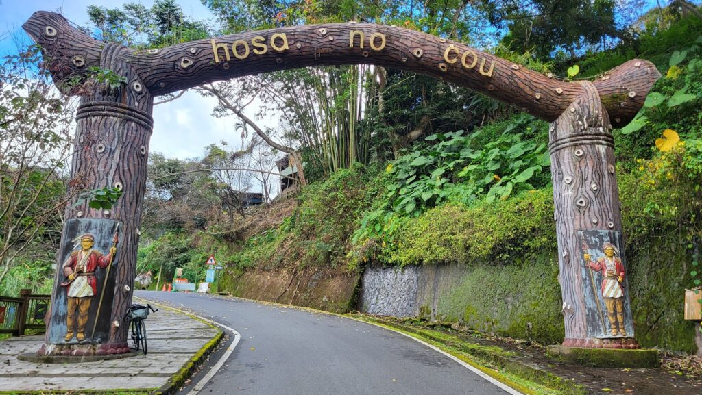
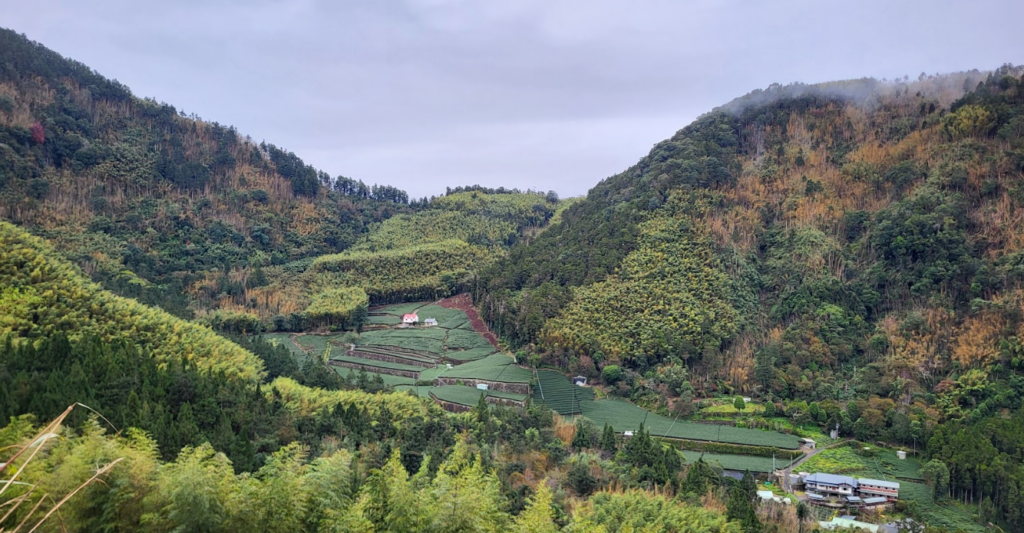
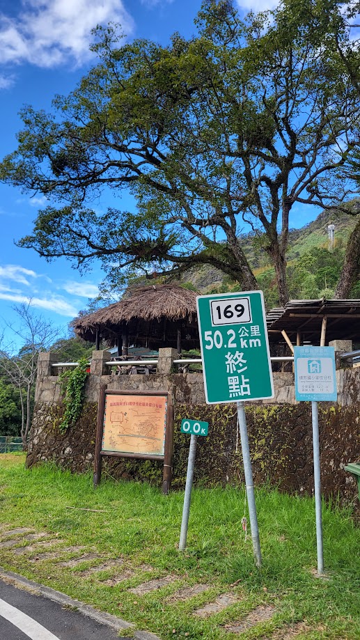
Shizhao is at an elevation of 1,300m. In order to complete the No.169, you are now faced with a 22km ‘descent’ to the indigenous village of Lijia. This area is the Tsou tribe’s heartland. In order to get to the end of the road at the 50km marker, there are three villages to pass through – Dabang, Tefuye, and Lijia at the end. These villages all have excellent tribal artwork, and both Dabang and Tefuye have fine examples of ‘Kubas’ – meeting halls made of wood and straw which act as congregation points for male members of the tribes. (Women are not allowed to enter). Tefuye is better known to most people because of its ancient traversing trail.

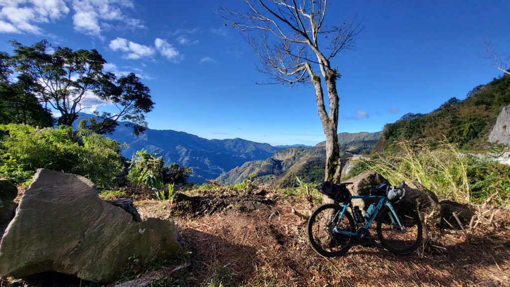
Apart from that, I would say the south section of the No. 169 is more impressive than the north; there are sweeping vistas of the surrounding hills, and it has to be said again, perhaps the best cycling roads in Taiwan. You will find a few small village shops, but not much food.
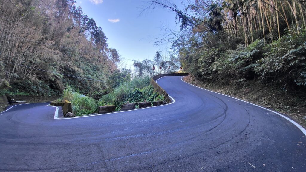
In order to avoid doing an out and back on the south section of the No. 169 from Shizhao, there is the option of accessing Tefuye from Shihzihlu on the ‘Basanadan’ communication road. The turn-off is at the 78km marker on the No. 18. This can be seen in the maps we have provided. It is an extremely steep descent on a concrete road that I never want to ride up.
I would advise anyone doing this ride to break it up into two days with an overnight in Shizhao. If the rider wanted to complete the 169 in a single ride with an approach from Yunlin and then descend to Chiayi, it would involve 180km with over 4,000m of ascent.
Here is the GPS information for the north part of the No. 169 starting from Dounan:
This second map shows the south section with an alternate route to Tefuye.