Location: Nantou/Changhua/Yunlin Counties
Distance: 72km Elevation Gain: 500m
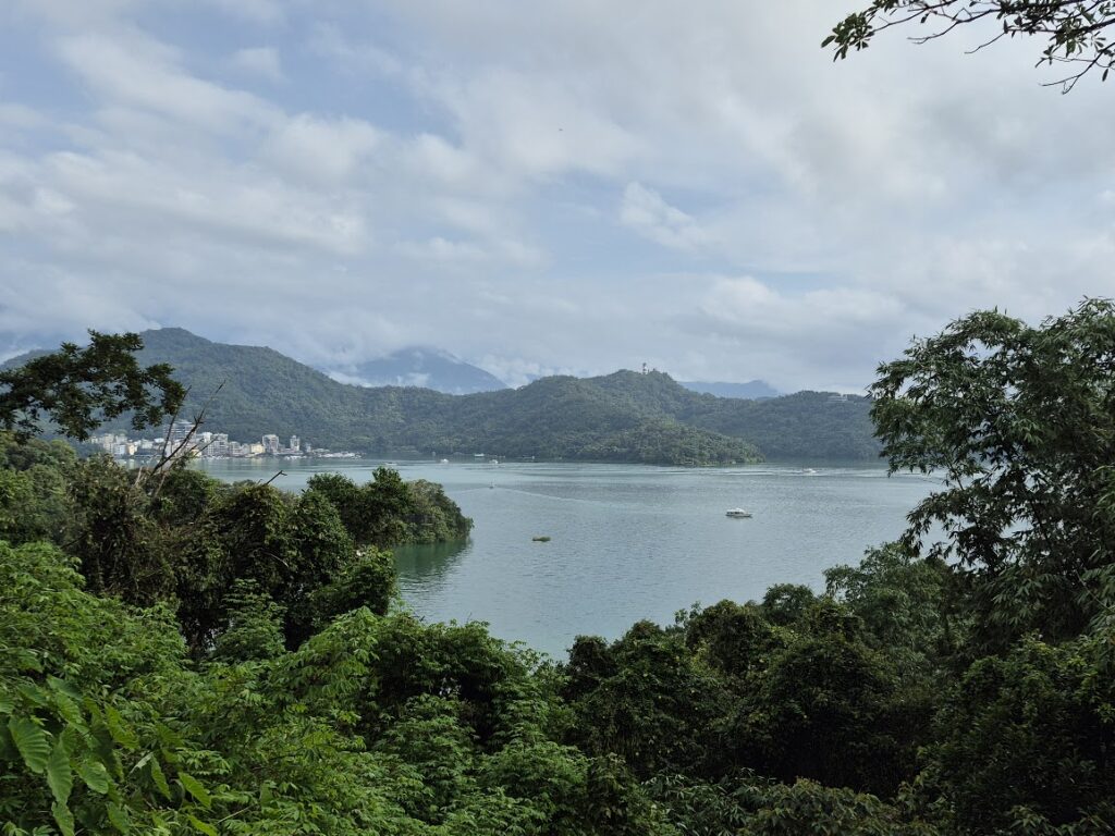
Sun Moon Lake has been covered extensively in our posts, and this will most likely be the last post to do so. In our three previous posts, #071 to #073, we outlined routes that traverse from Hsinchu in northern Taiwan to Nantou in central Taiwan through the hills that run parallel to the central mountains. This is an excellent alternative route to avoid the more congested and populated west coast.
So, this is the fourth post offering what we consider a far more enjoyable and less crowded means to navigate north to south away from the dull ‘Cycle Route No. 1’ touted by those less imaginative types. Actually, as this route starts in the center of Taiwan, it’s as much an east-to-west section.
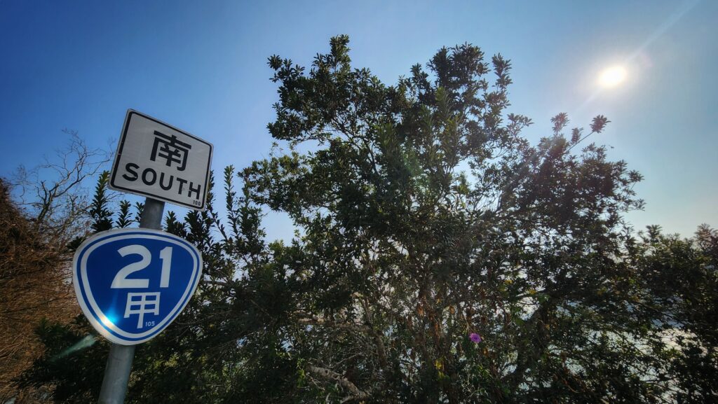
Starting from Ita Thao on the east shore of Sun Moon Lake on Provincial Highway No. 21A, the ride starts with a moderate grade uphill for a 100m ascent. While Provincial Highway No. 21 can be really busy on weekends, weekdays in the early morning, it’s likely to be quiet. The No.21, AKA the ‘New Central Cross-Island Highway’, has been covered extensively in previous posts #007 and #054.
After 5km around the south of the lake, you start the downhill section of the ride where the No. 21A joins the No. 21, then it’s a rocket downhill on great surface. At the end of the descent, the rider will come to the intersection with Provincial Highway No.16. Take a right turn here heading west towards Shuili town. Along this road, you’ll see signs for Shuili Snake Kiln Ceramics Cultural Park, which is well worth a visit.
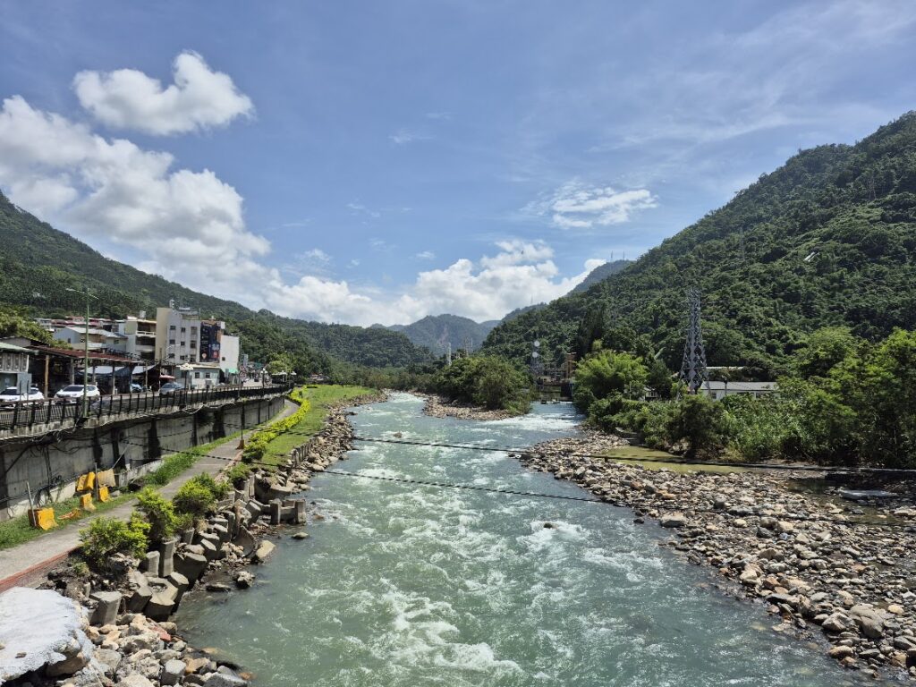
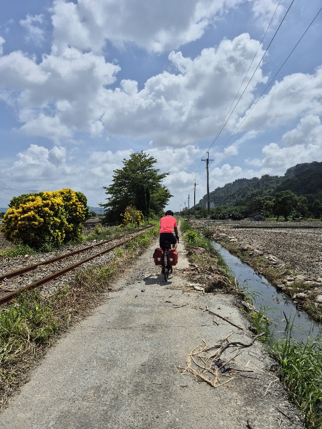
Shuili Township is the largest population center in this area and one of the main stops on the Jiji Train Line. This is the best place to refuel before your onward journey. From Shuili, the easy option to get westward would be to follow the No. 16, but a much better scenic route is to take local road Tou 27. This has a fairly steep ascent at the beginning, but only goes up 100m or so. This road follows the train line and offers great views of the Zhoushui River.
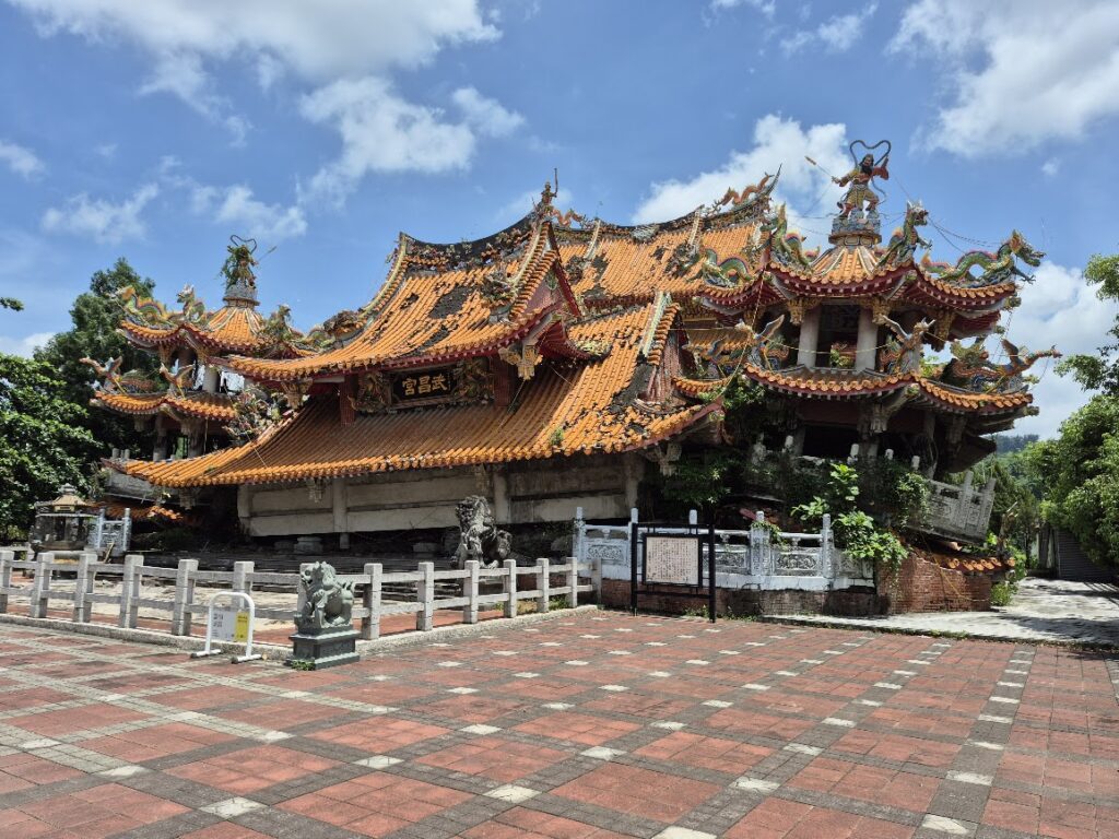
Around 35km into the ride and just off the Tou 27, it is well worth a detour to the Jiji Wuchang Temple – this is a well-known tourist attraction which is more commonly referred to as the ‘Earthquake Temple’. The ground floor of the building collapsed during the 1999 earthquake.
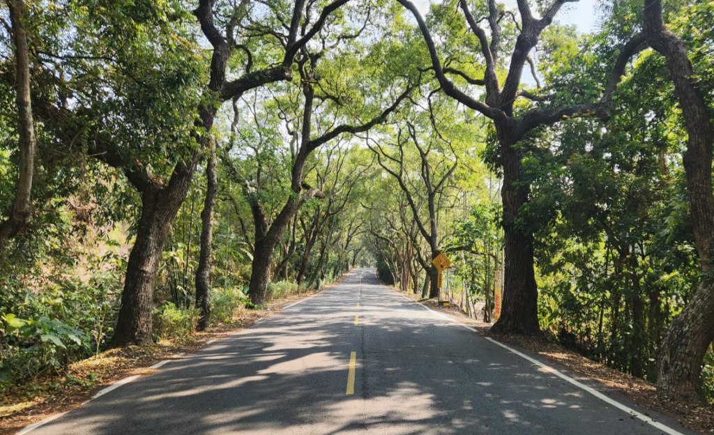
Jiji town is the next stop on the route, and this is the best place to pick up supplies. The town is also famous for the variety of bananas available at local stalls. From this point, the rider has two options for getting back to civilization and a train station home. If you are heading back north, follow the No.152 due west to get to Ershui train station. This road is the ‘Jiji Green Tunnel’ and is very popular as a tourist ride following the train tracks.
If you are heading south, just before Ershui, take a left on the No.141 Rd. to connect to Provincial Highway No. 3, which leads directly to Douliou which is the main city of Yunlin county.
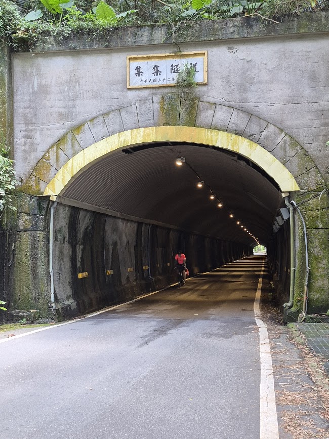
Here is the GPS info to Douliu, which features the Jiji Tunnel.