Location: Nantou County
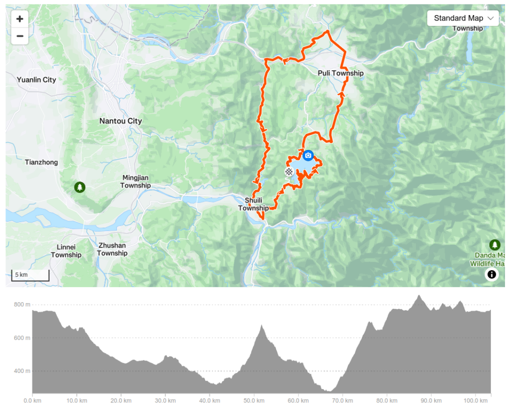
Distance: 104km Elevation Gain: 1500m
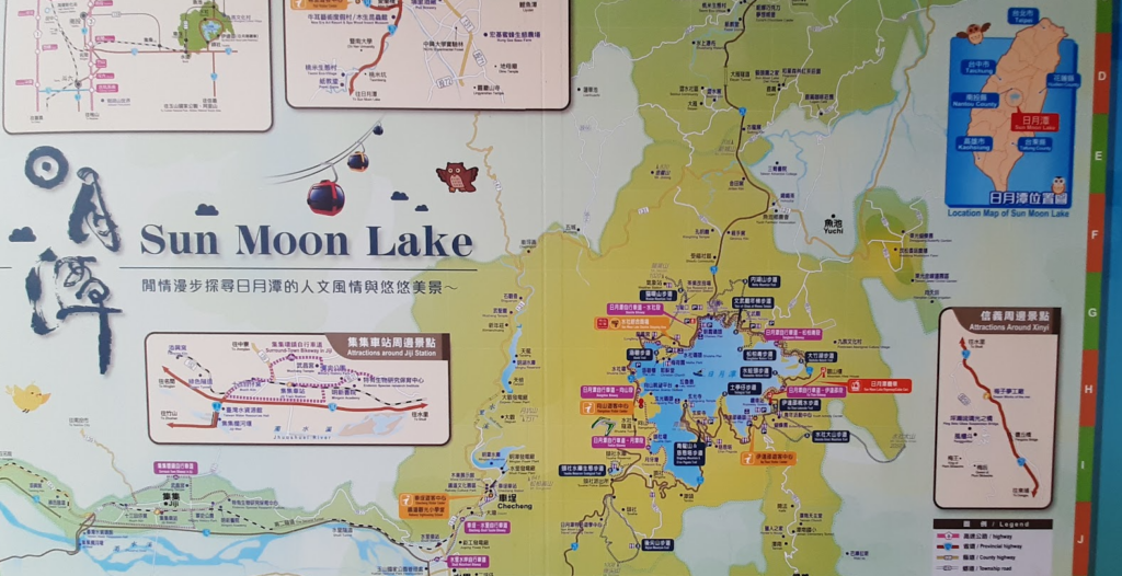
Sun Moon Lake: A Tour de France-Inspired Ride in Taiwan
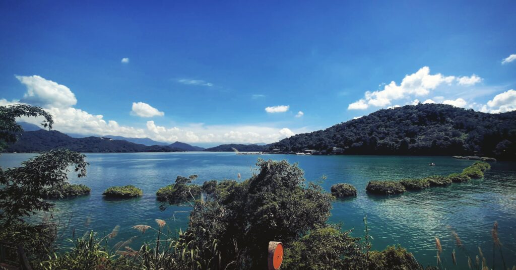
Sun Moon Lake has always been one of Taiwan’s most picturesque cycling destinations, now thanks to the support of the L’Étape Series by Tour de France, it has gained even more worldwide recognition. It would be a crime not to include this route in our top 100 climbs because, let’s face it, nobody can argue that the Tour de France is the most famous cycling event in the world. Even people who aren’t into cycling know about it.
Taiwan is fortunate to have a connection to this legendary race with the L’Étape event, which has been scheduled for October this year (2025) after a successful run last year. L’Étape is a global series of amateur cycling events inspired by the Tour de France, offering riders a chance to experience professional-style racing. It takes place around the same time as the Taiwan KOM Challenge, making October and November prime months for cycling enthusiasts. In this post, we’re diving into the details of the Sun Moon Lake route, and what makes this area an incredible cycling destination. We have also covered various climbs up to the lake in post #23.
This ride is part of our Top 100 climbs series, and while many of our routes can be explored at your own pace, this one is a full-on race. If you’re looking for an organized challenge with a great atmosphere, this is the ride for you. While I haven’t participated in L’Étape myself, I’ve done the route numerous times and can vouch for its beauty and intensity. So doing this solo or taking part in the event – either option you are in for a great experience.
Overall Route Breakdown
The 104-kilometer route features around 1,500 meters of elevation gain, making it a challenging yet manageable ride for experienced cyclists. There is also a 29-kilometer route around the lake but in this post, we will focus on the 104km race. Let’s break it down step by step. Also if you intend to do this route from Taichung or a start location in Nantou, it is completely doable in a day from either start location, as a solo or small group ride.
The Opening 30km: Fast Downhill
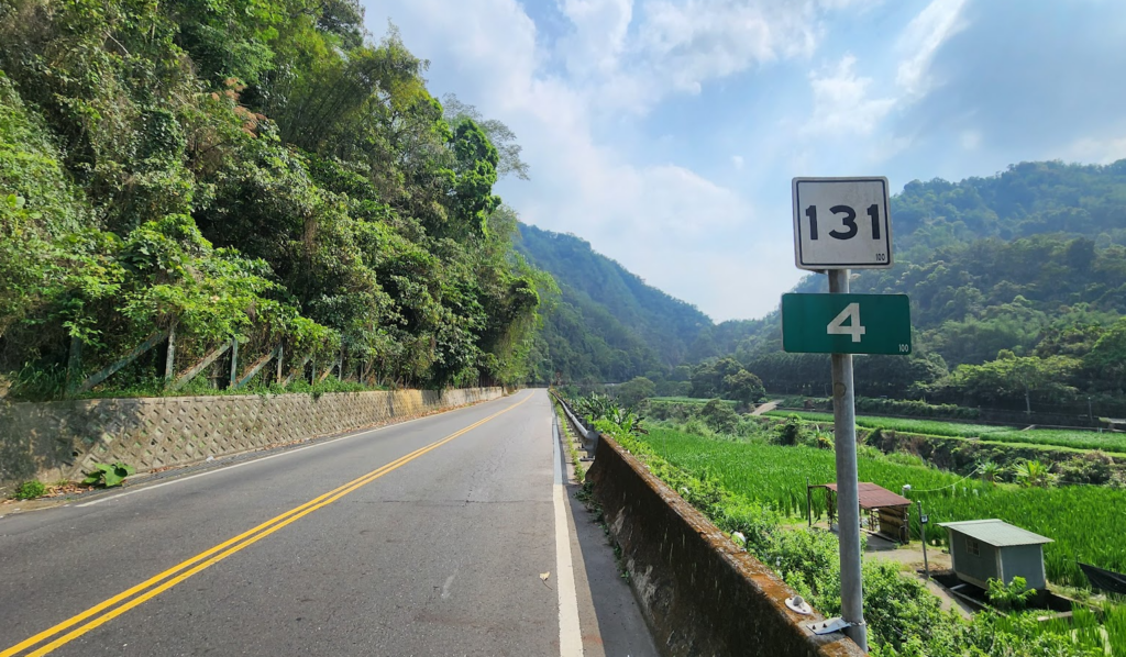
From the start line, you’ll descend quickly down Provincial Highway No. 21 through Yuichi Town and onto County Road No. 131. This stretch is mostly downhill, with a gradient ranging from -1% to -4%, allowing riders to gain speed quickly. You’ll cover nearly 20km of descent before reaching Puli.
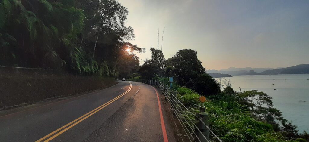
While this downhill section is fun, it’s also a time to be extra cautious. With a large group of riders, high speeds, and morning light conditions, this section requires sharp focus.
The Middle Section: The Climb Begins
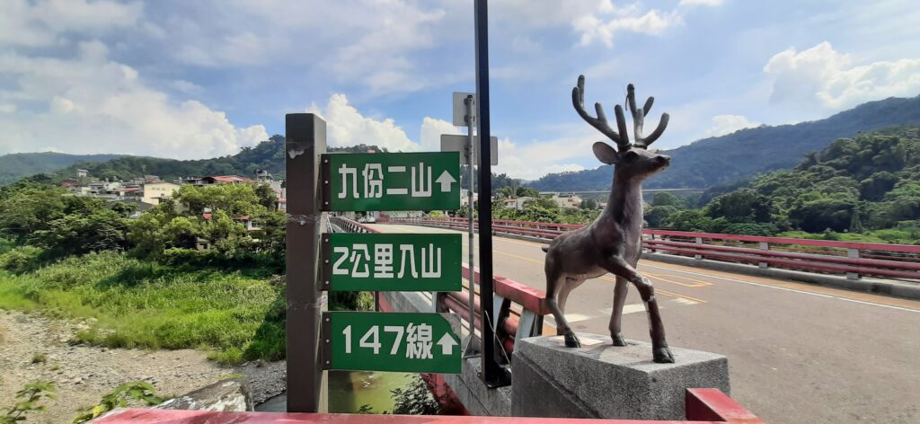
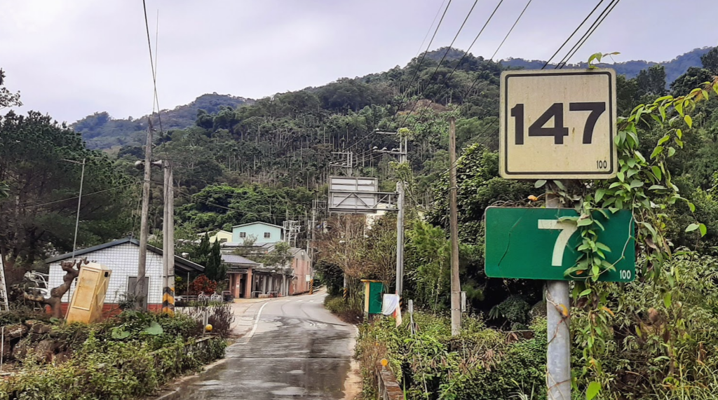
Once you leave Puli around the 28km mark from the start line, the terrain changes. You’ll pass through two tunnels before hitting County Road No. 147, where the real climbing begins. If you are doing this route solo there is a Family Mart tucked away after crossing the bridge, just take the second left in the little town and you will see it. The first 5 kilometers of this section are mild, with gradients between 2-5%, but don’t be fooled—the difficulty ramps up fast.
From the 7km marker on No. 147 to the 10.5km marker, you’ll face gradients of 7-12%, making this the steepest section of the event. A gazebo marks the top of this climb, but don’t expect a long break—there’s a fast, winding descent right after. A noteworthy update for cyclists in Taiwan: This road was recently repaved. For years, the 147 featured sections of deteriorating single-lane gravel/dirt road moments, but after two years of reconstruction, both the 147 and 131 to Shuili are now in top condition.
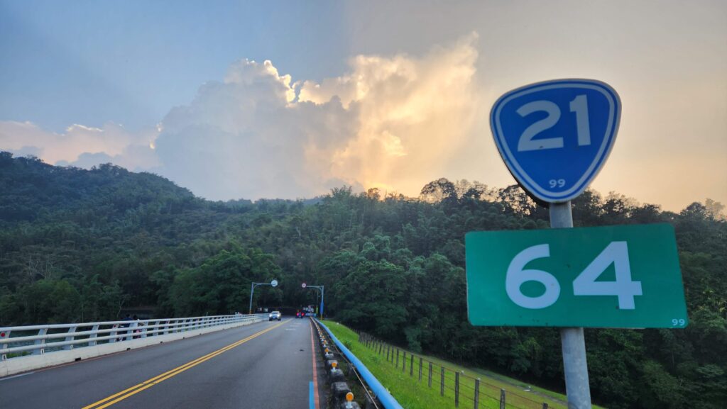
The Final Challenge: Route 21 Back to the Lake
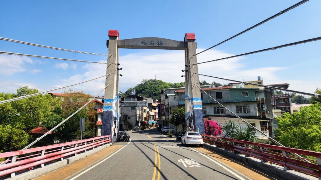
After a mix of rolling terrain on No. 131, you’ll hit No. 21, which brings a solid 9km climb back up to Sun Moon Lake. While in Shuili you might consider stopping to refuel, there are plenty of places to choose from. As for the 21 from Shuili to Sun Moon Lake, the gradient is mostly 4-6%, with a brief downhill section offering a quick breather. This road used to feel like a nemesis to me, but once you find your rhythm, it’s a rewarding climb.
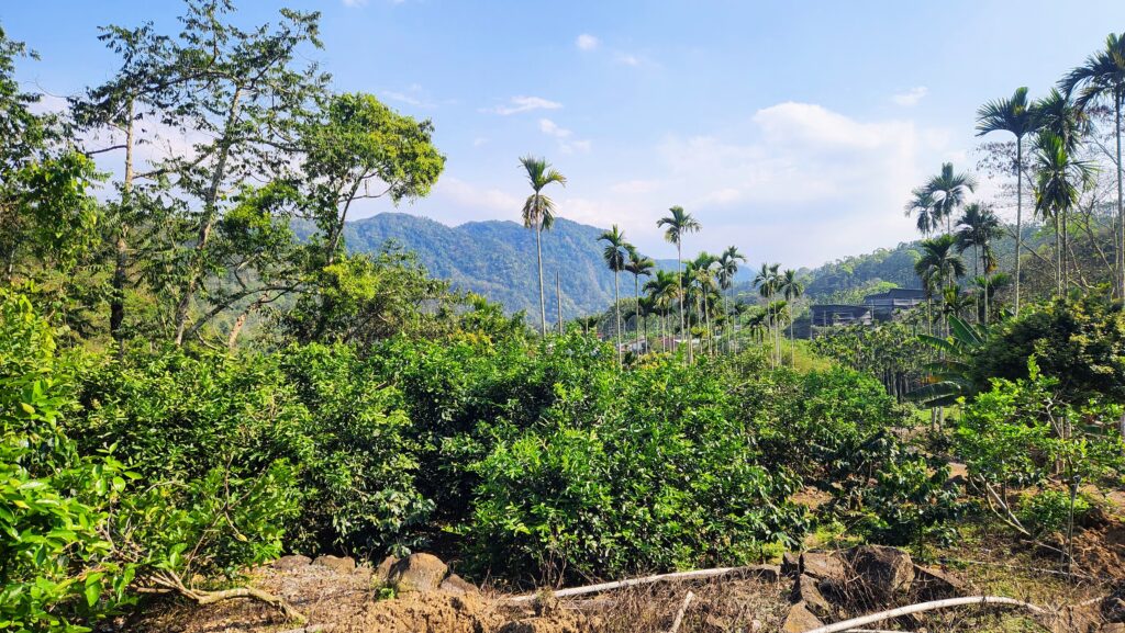
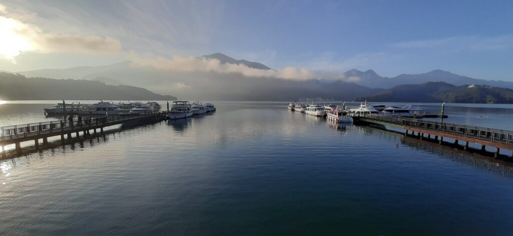
Even after reaching Sun Moon Lake, you’re not done yet. The race route takes you around most of the lake, where you’ll face short but punchy climbs before rolling toward the finish line. The entire circuit around the lake is 32km, but the race covers about 25km of it before concluding.
Why This Ride is Worth It
L’Étape Taiwan is an excellent way to showcase Sun Moon Lake and Nantou County to both locals and visiting cyclists. The weather in October is generally ideal—though it can get hot, with afternoon temperatures reaching 33-34°C. The scenic views, the thrill of the race, and the challenge of the route make this an unforgettable experience.
If you’re an experienced cyclist, you might even consider pairing this event with the Taiwan KOM Challenge, making for an epic cycling trip. Whether you’re here to race or just ride the route on your own time, Sun Moon Lake is a must-ride destination in Taiwan.
A final note from a participant in the 2024 event, a long-time Taiwan resident from Canada, Johan Kromhout shares his experience:
“Waking up at 4 a.m. isn’t so tough when you’re gearing up to ride alongside thousands of enthusiastic cyclists—and a couple of absolute legends. The late-November chill at Sun Moon Lake was in full force, and this morning was no exception. My Garmin read a brisk 9°C as I swung my leg over the saddle, joining the parade of flashing tail lights and the symphony of freehubs buzzing through the cold air. The short ride to the start line was both a blessing and a curse: my legs warmed up slightly, but the icy breeze cut through my layers, chilling me to the bone. Then, as if on cue, two cycling titans: Chris Froome and Mark Cavendish—strolled past, just an arm’s length away. A surreal moment. With the first pedal strokes, we rolled away from the massive visitor center into the darkness, tracing the edge of the lake. The cold still lingered, but adrenaline and a rising heart rate quickly took care of that. As the sun crept over the horizon, mist draped itself over the surrounding hills, transforming the landscape into something almost mythical. Groupettos snaked through valleys and over punchy climbs, past farmers easing into their morning routines, and along roads that felt impossibly remote—yet, in typical Taiwan fashion, were flawlessly paved. As the ride wore on, settling into small groups proved, as always, to be one of the best parts of a sportive. The miles melted away, and before I knew it, we were back on roads with sweeping views of the lake. Near Xuanguang Temple, the crowds roared, running alongside us, handing out juicy cherry tomatoes and half-bananas as we rounded a tight switchback. The final stretch was nothing short of breathtaking—winding roads, glistening water, and mountains rising in the backdrop. A few of us sprinted for the finish line, not for a result but for the sheer joy of it. As I rolled to a stop, heart pounding and a grin plastered across my face, I knew one thing for certain—I’d be back for 2025.“
Here is the GPX information: